Located near the border between California and Nevada, Death Valley National Park is an alien landscape famous for being both the lowest and hottest place in North America.
Welcome to Mars!
That was my first thought on driving into the massive, epic, and multi-colored landscape that makes up Death Valley National Park. Clocking in at nearly 3.4 million acres, Death Valley is the largest Park in the mainland US and the 5th largest overall in the Park System (behind 4 parks in Alaska).
A short 2-hour drive from Las Vegas, Death Valley exists entirely in its own world, consisting of red and yellow striped cliffs, bizarre rock formations, and a massive salt basin that marks the lowest point in North America. My one regret with this blogpost is that given Death Valley’s sheer size, there’s no way to do it justice without a proper week+ long stay in the region, but I will do my best with the 2 days I spent there:
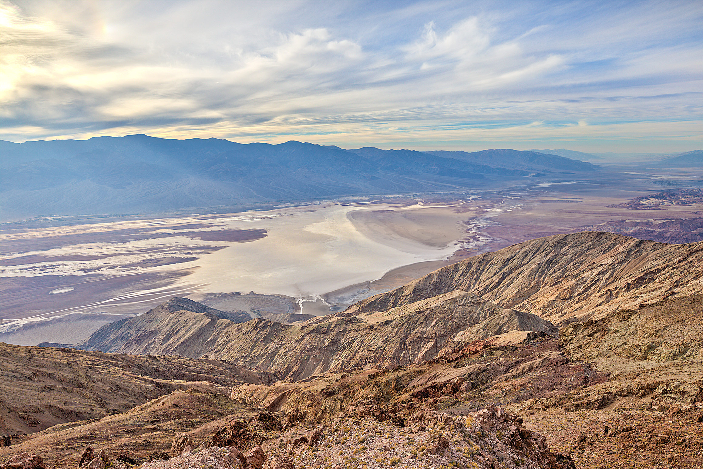
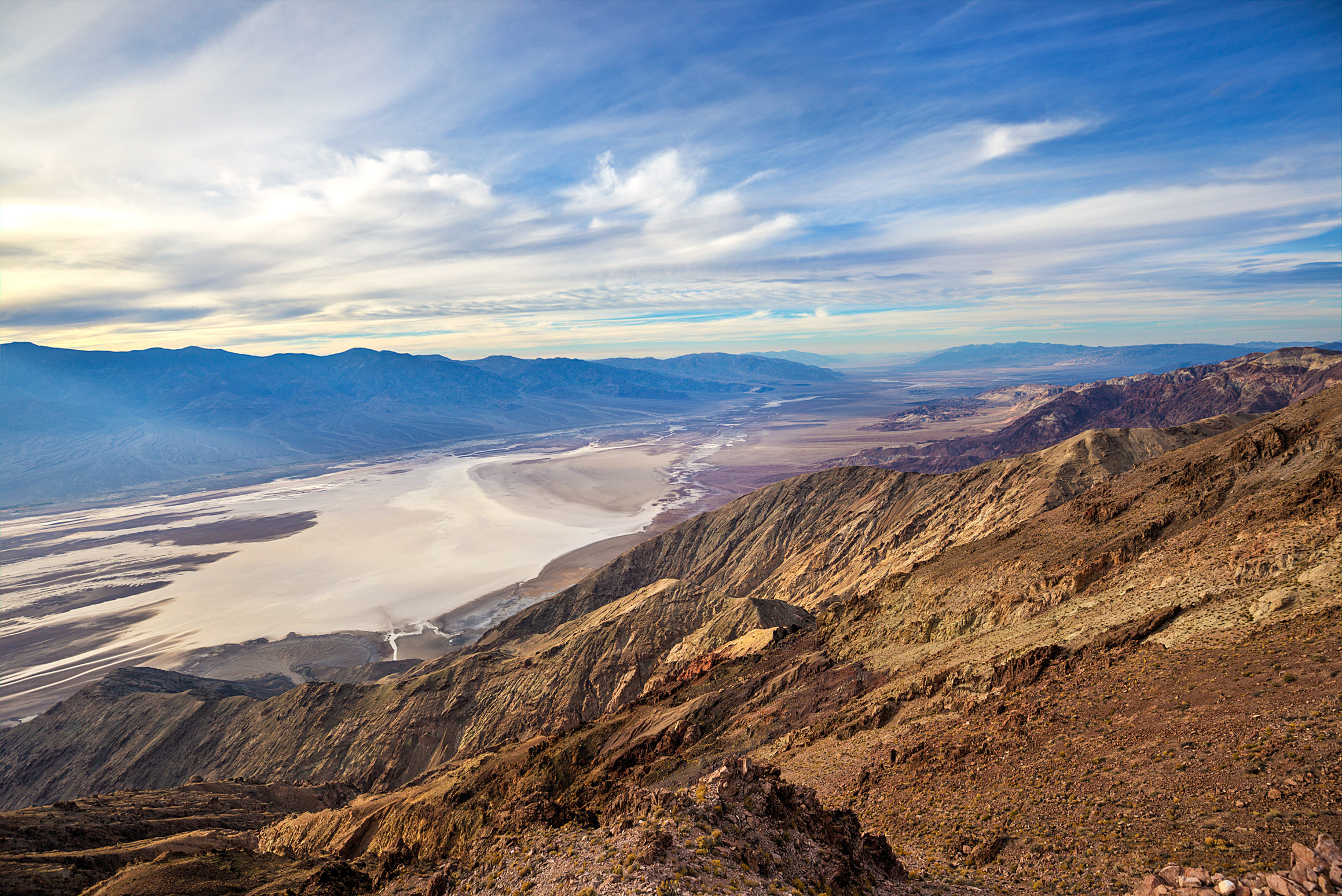
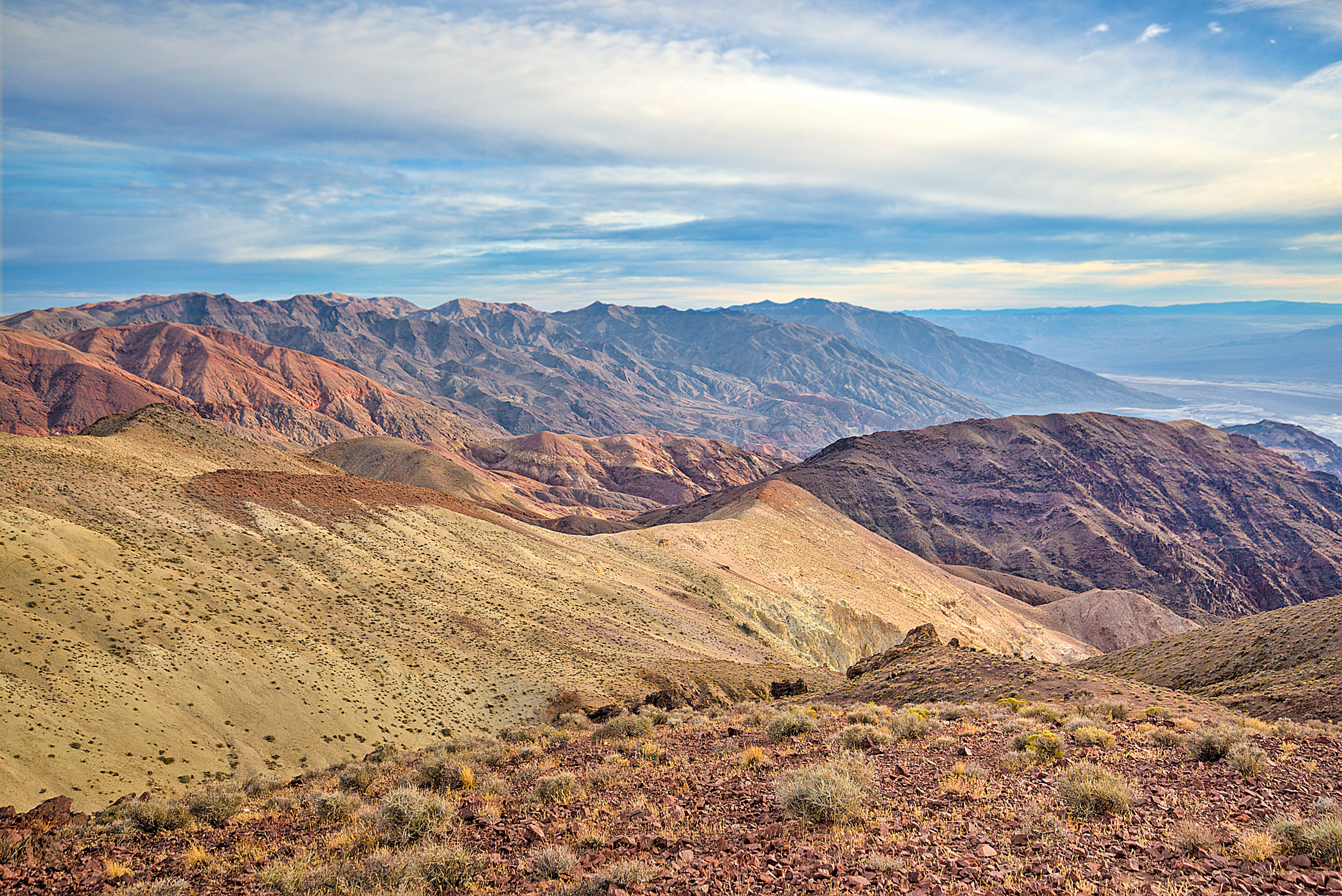
1) Dante’s View-The first stop from the Eastern entrance (Vegas side), this viewpoint provides epic views of the Badwater Basin and the mountains around Death Valley. There’s several short uphill hikes from the parking lot that are 100% worth it if you have the time and energy:
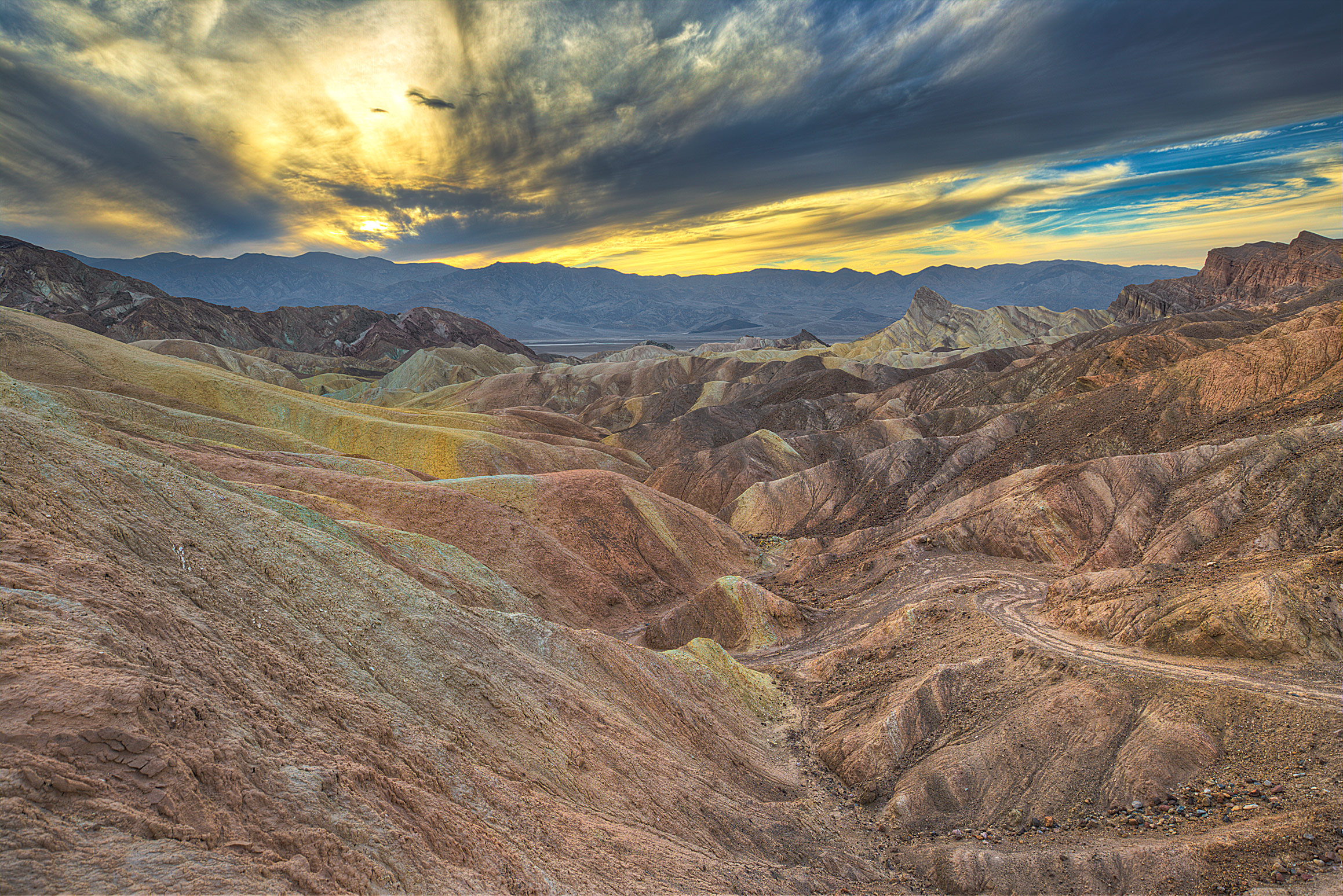
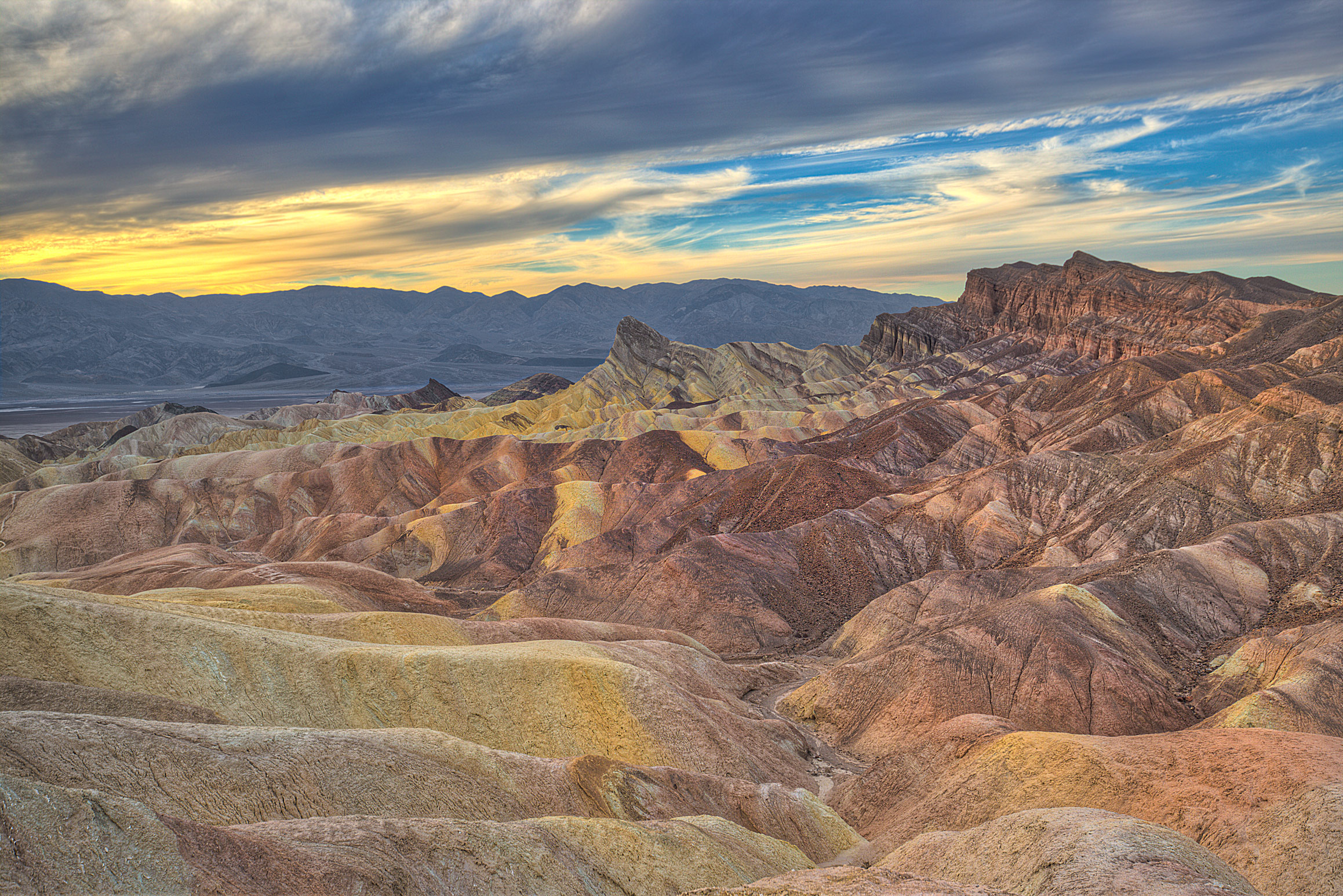
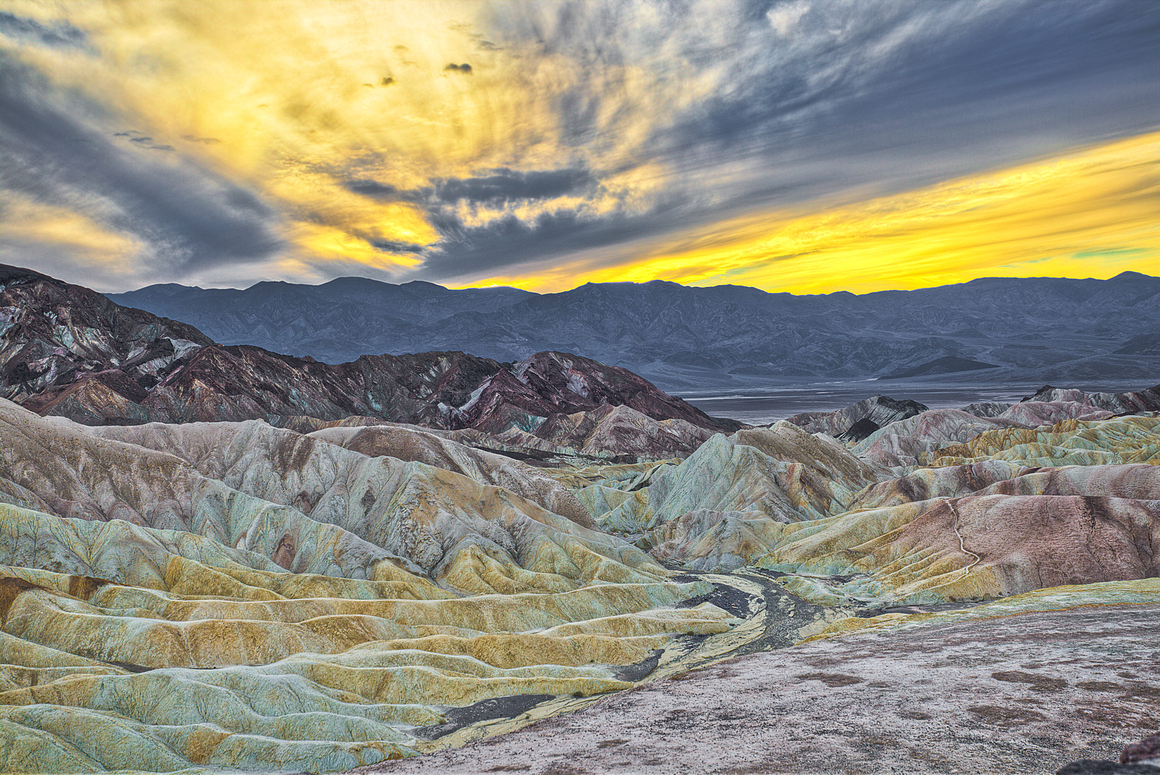
2) Zabriskie Point– Today’s cover image- a landscape so strange that you won’t believe it actually exists until you visit! As the pictures indicate, I arrived right at Sunset (roughly 4:30pm without DST) and got to witness an epic sky full of fiery clouds!
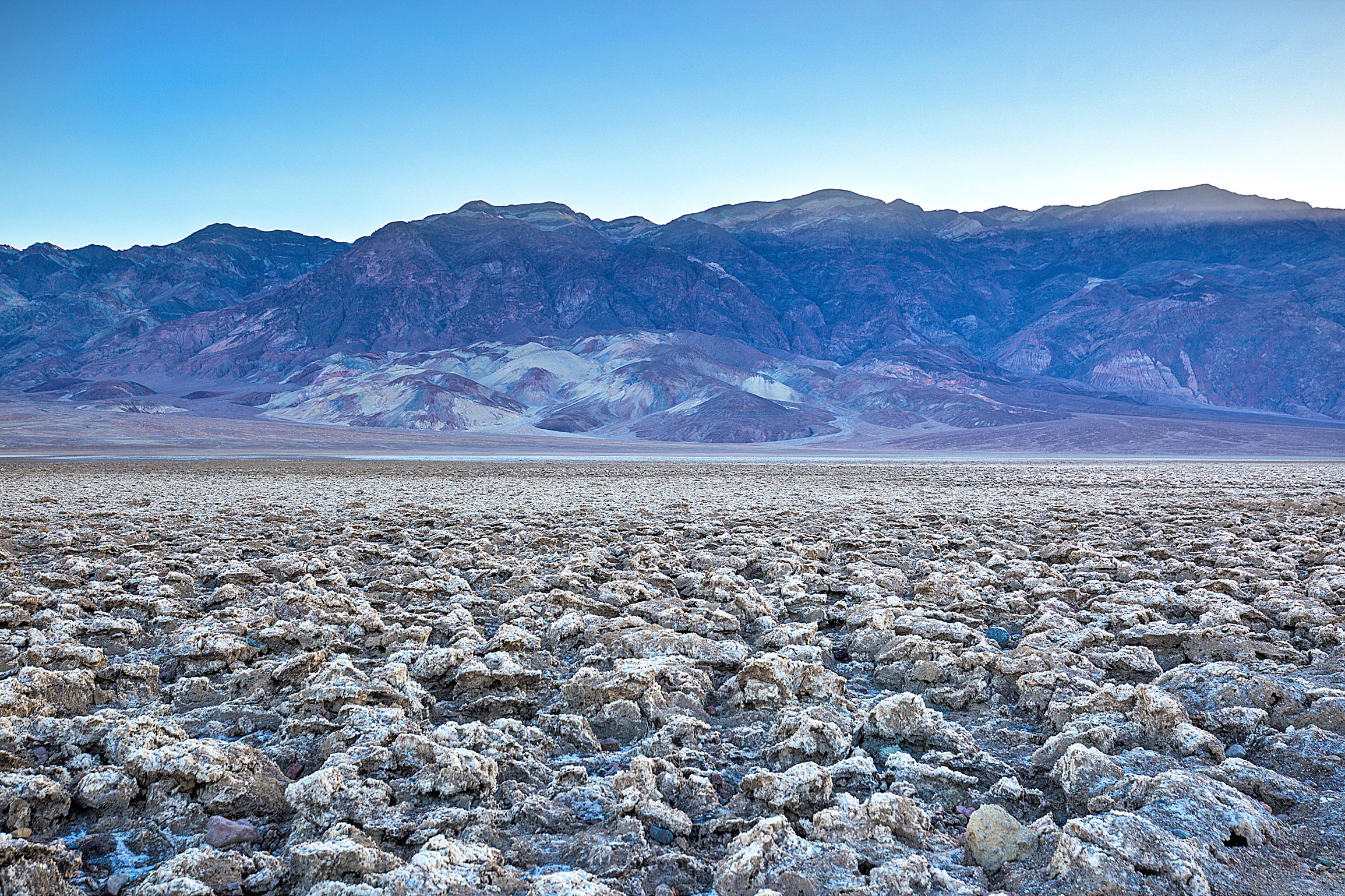
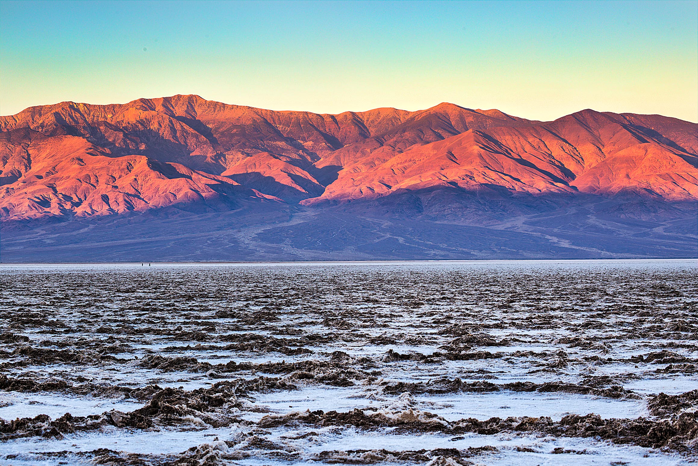
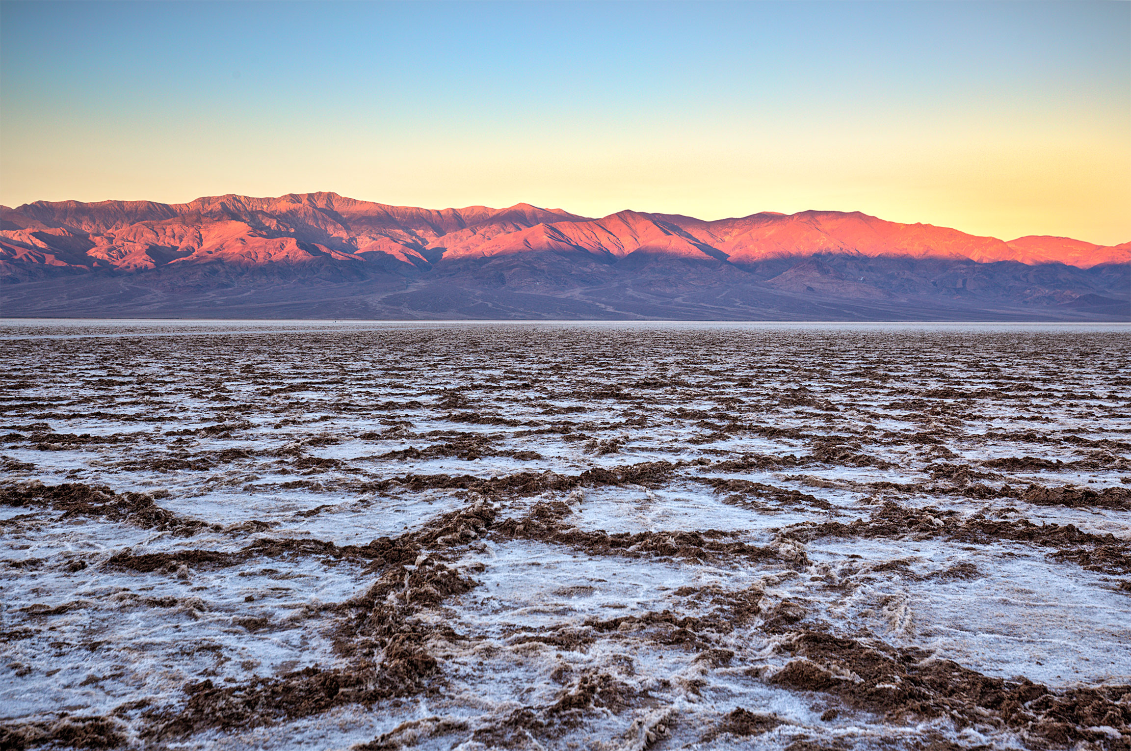
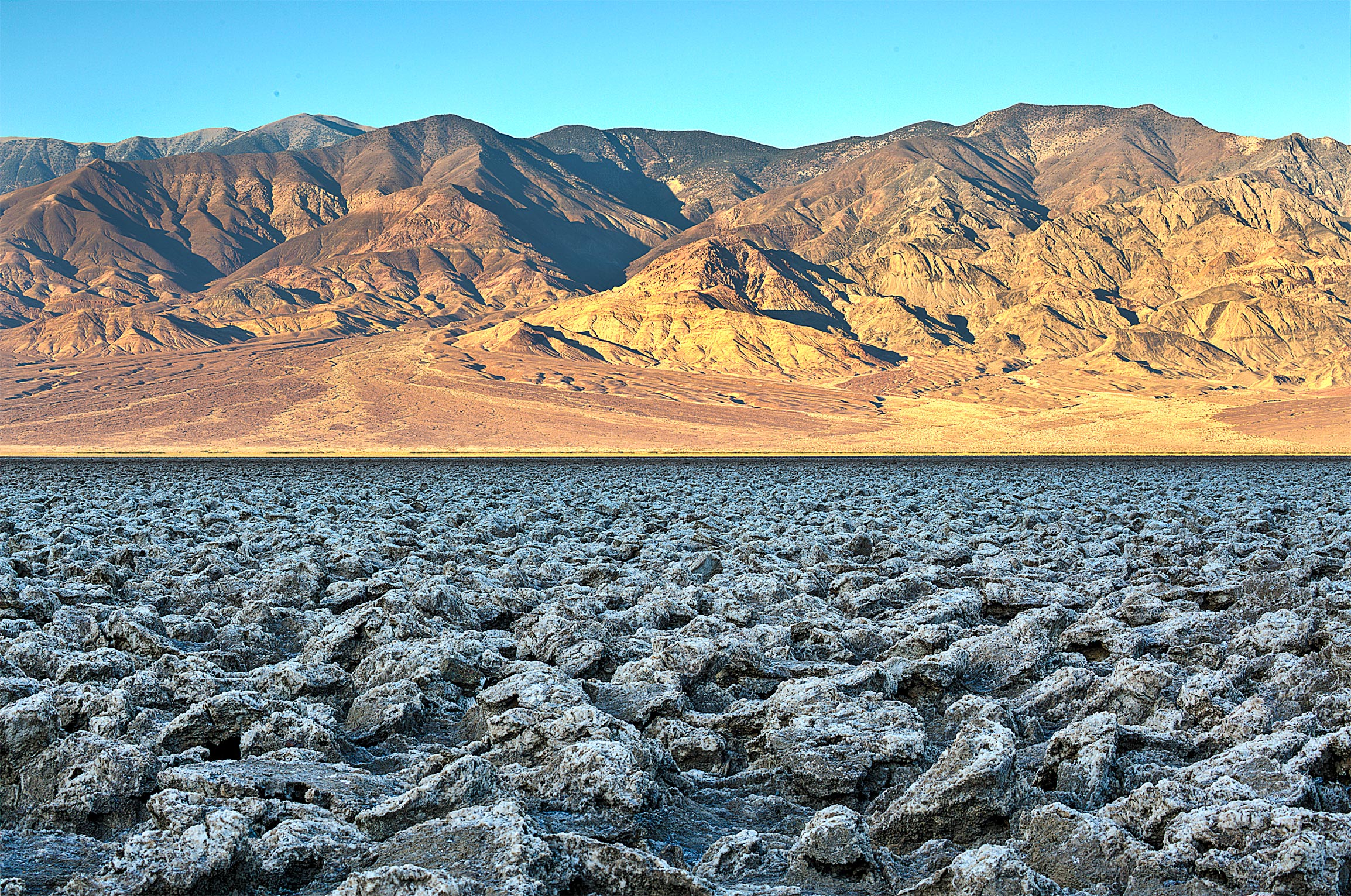
3) Badwater Basin– The lowest point in North America. I arrived at Sunrise, expecting this place to be deserted, but strangely there was an entire gang of elderly photographers with tripods taking a photography class! Luckily they were super friendly and very helpful- evidently they come here all the time. Pay close note to the terrain in these photos- this place is treacherous to walk on and not for the clumsy:
4) The Devil’s Golf Course- I take back what I said about Badwater Basin being treacherous to walk on- this place takes that to a whole new level! Surrounded on all sides by miles of sharp rocks, this place is the true epitome of the bizarreness of Death Valley:
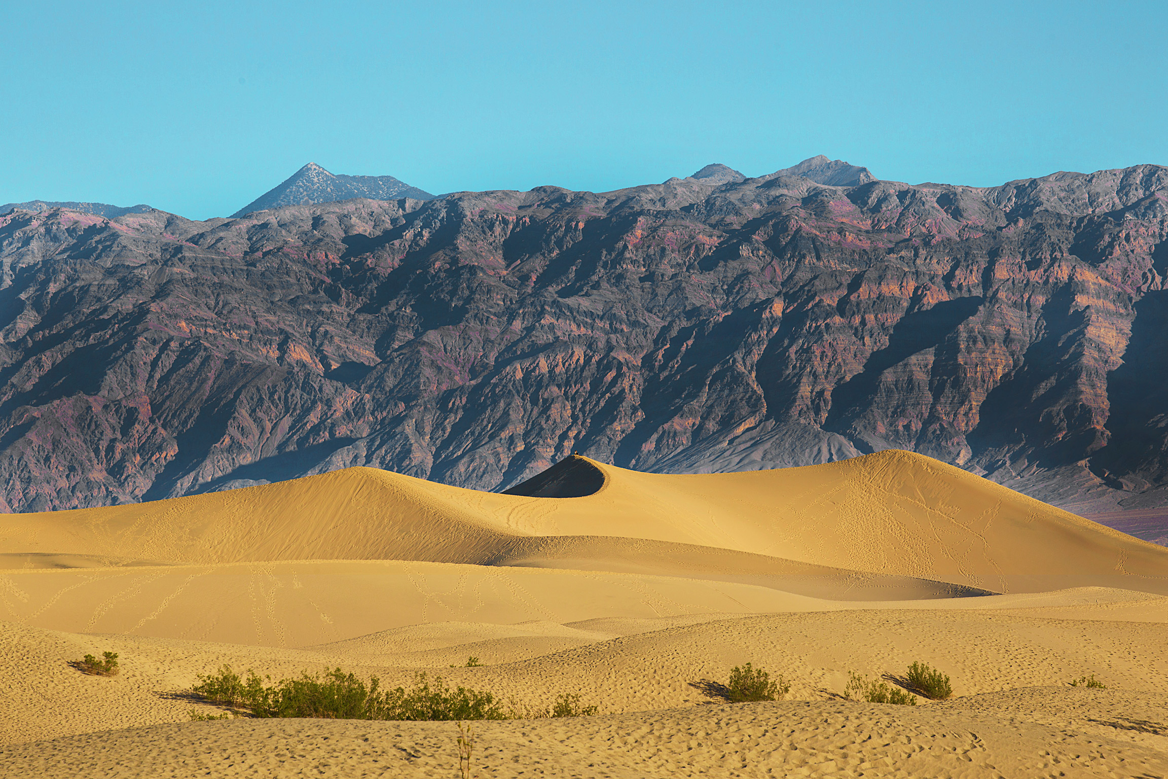
5) Mesquite Sand Dunes: This place helped me realize that I’ve become a true National Park snob, as my first thought was “cool, but not as impressive as the “GREAT Sand Dunes…” Definitely worth seeing, maybe not hiking though, asthe dunes themselves are over a mile from the trailhead.
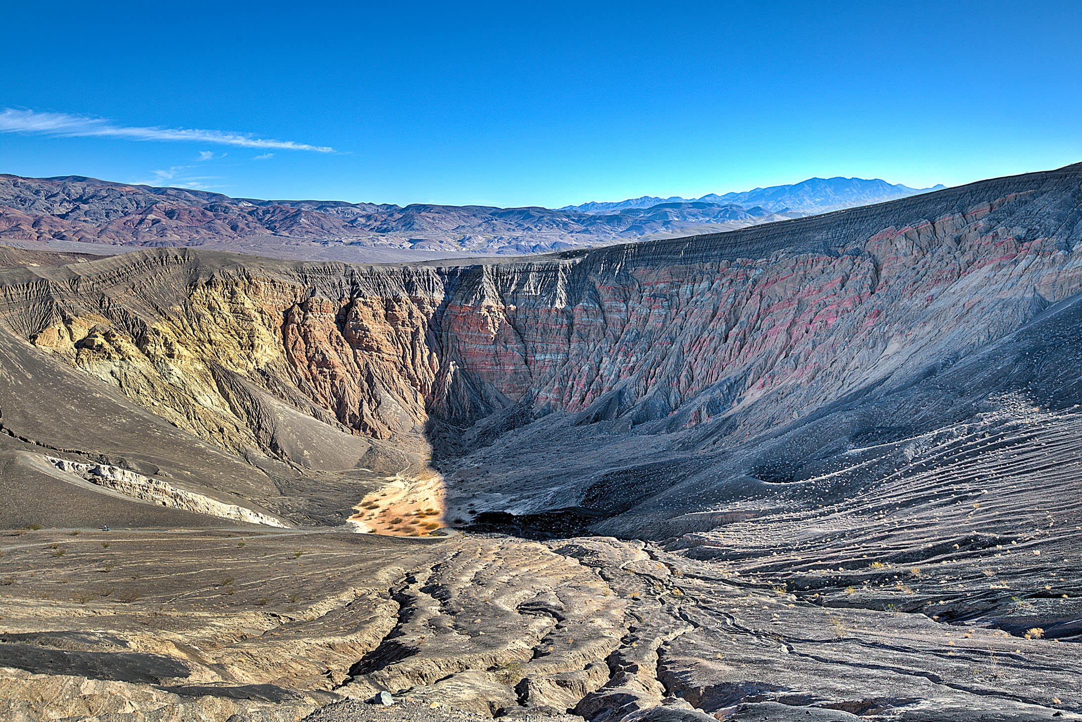
6) Ubehebe Crater: It takes about an hour and a half-drive(round trip) to get to this place, but it’s pretty cool! Basically just a giant hole in the ground that you can hike inside or around- I tried a little bit of both and found the outside hike to be more rewarding.
That’s it for now. Next up I am taking a short break before heading to my final back in California and my last National Park before New Years, the amazing Joshua Tree!
-MB
Bonus Images: