If Zion is an oasis in the desert, Bryce Canyon is a desert in an Oasis.
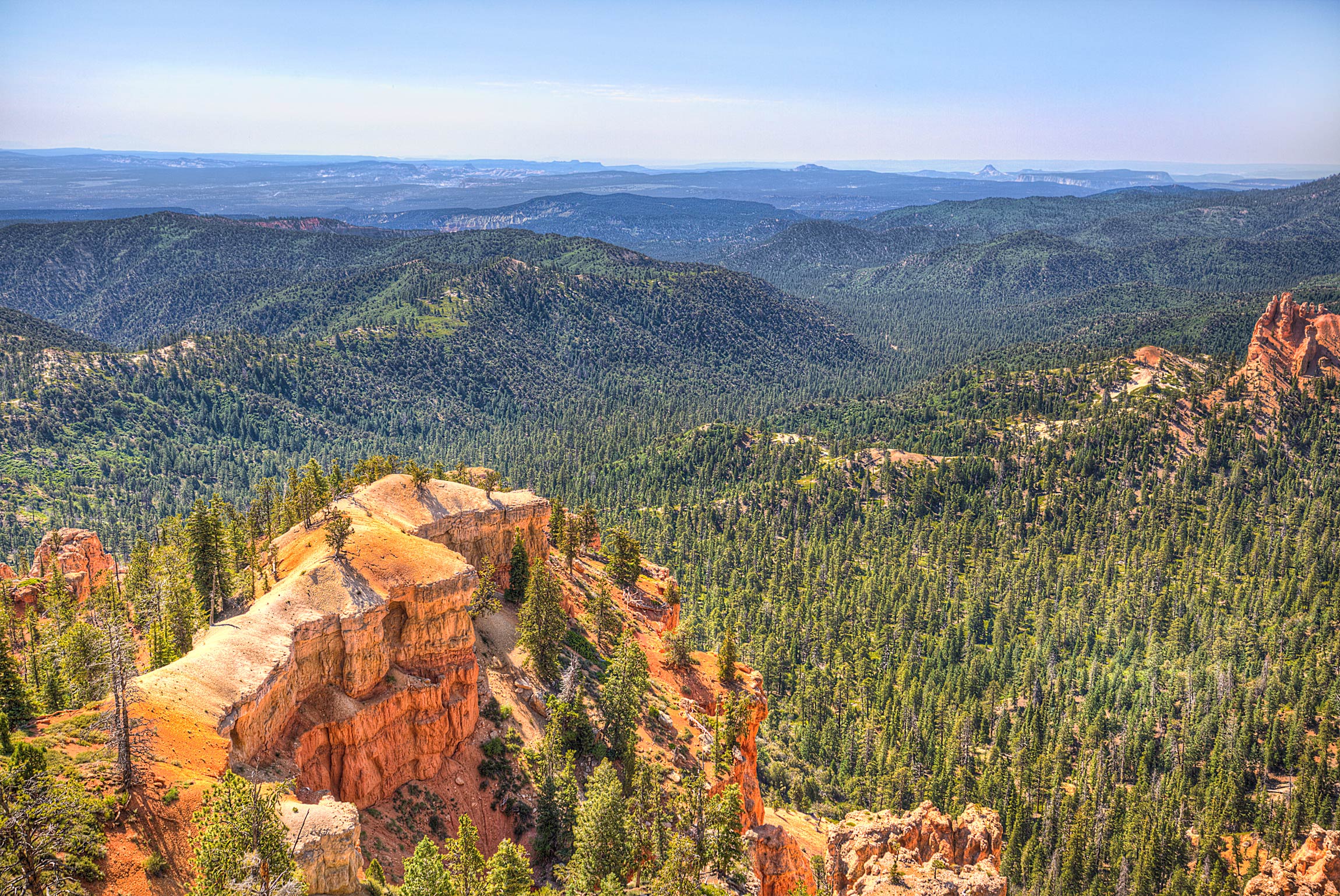
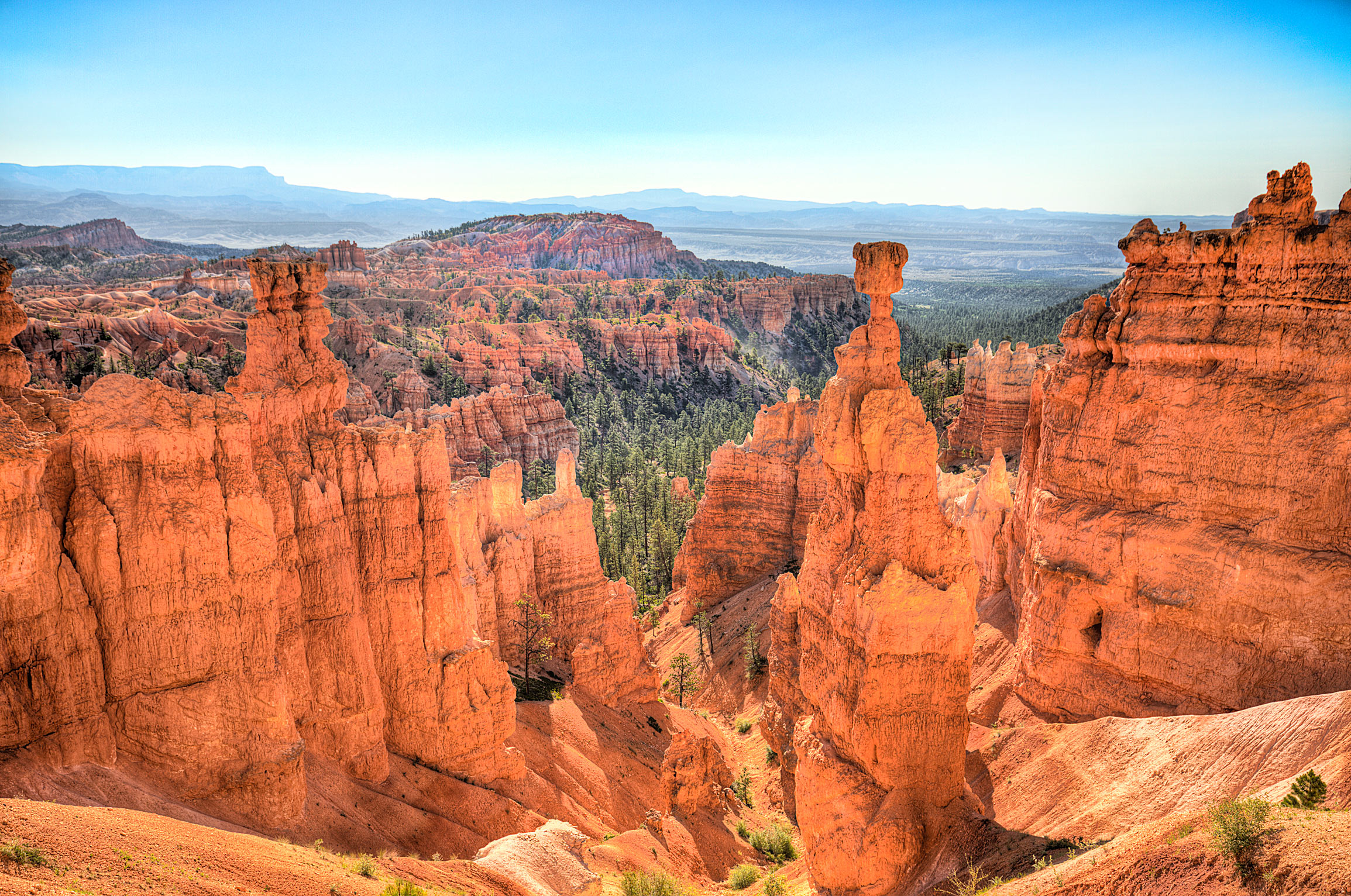
Located roughly 1.5 hours north east of Zion National Park in southern Utah and surrounded by National Forests, Bryce is unique not only because it is not actually a canyon (pretentious geologists would say “it’s an amphitheater”), but also because it is littered with miles and miles of massive, totem-pole like rock formations called “hoodoos.”
The first non-native to settle in Bryce Canyon was a man named Ebenezer Bryce, who was a Scottish immigrant and Mormon missionary. Disowned by his family after converting to Mormonism, poor Ebenezer somehow managed to migrate to the US, find his way to Southern Utah, and start a farm in Bryce Canyon in 1874. Declaring famously that the area was a “helluva place to lose a cow,” Ebenzer would in fact lose all of his cows due to drought and be forced to move to Arizona in 1880.
The area would go largely uninhabited until 1923, when in an effort to protect the land from rampant logging and poaching, the Utah State Government petitioned President Warren G. Harding to protect the land under the awesome name of “Temple of the Gods National Monument”; however, the Government decided that name was a bit much and decided to keep the local name of “Bryce Canyon.” Harding would die two months later (historians might say “luckily died”), but his successor, Calvin Coolidge, would finish the job and declare Bryce Canyon the 19th National Park in 1928.
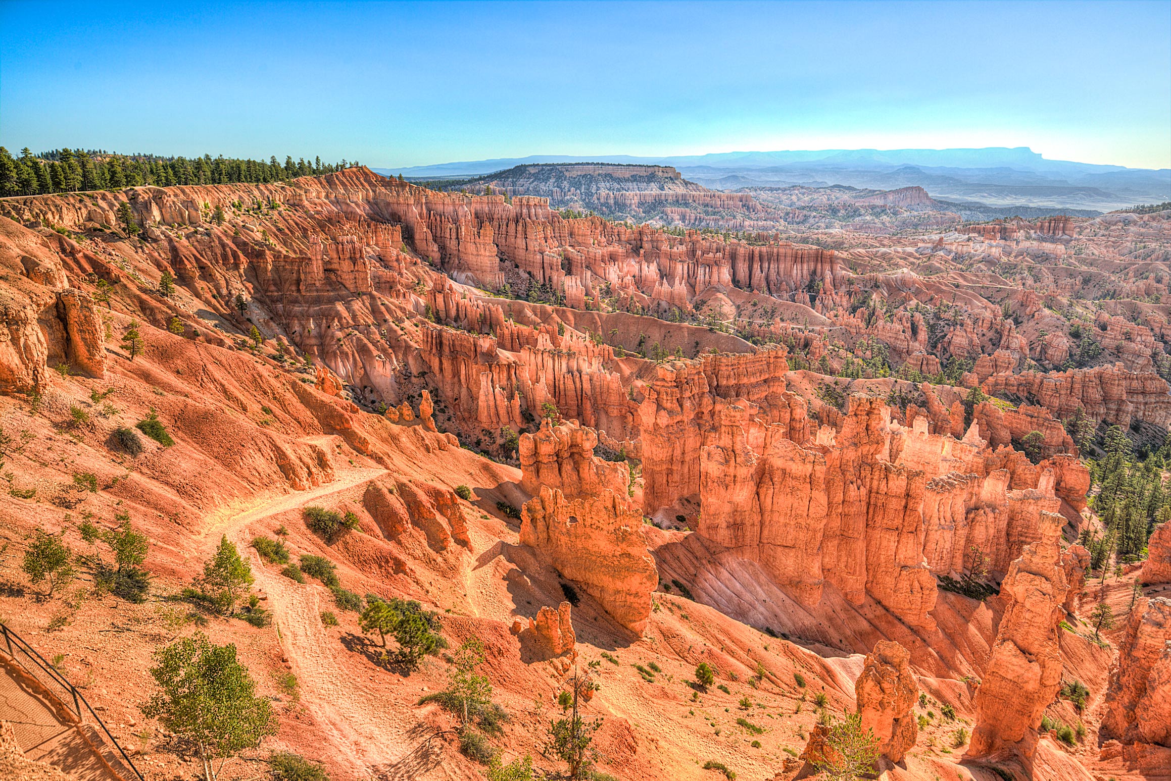
Today the park has been left remarkably unchanged with the “Rim Road,” built in 1934, still providing the primary means for seeing and exploring the park. Wrapping around the edges of the canyon amphitheater, the Rim Road provides dozens of viewpoints and overlooks, designed in such a way that even the laziest tourist (i.e. the one guy in flip flops who is at every National Park) can see the main sites of Bryce Canyon.
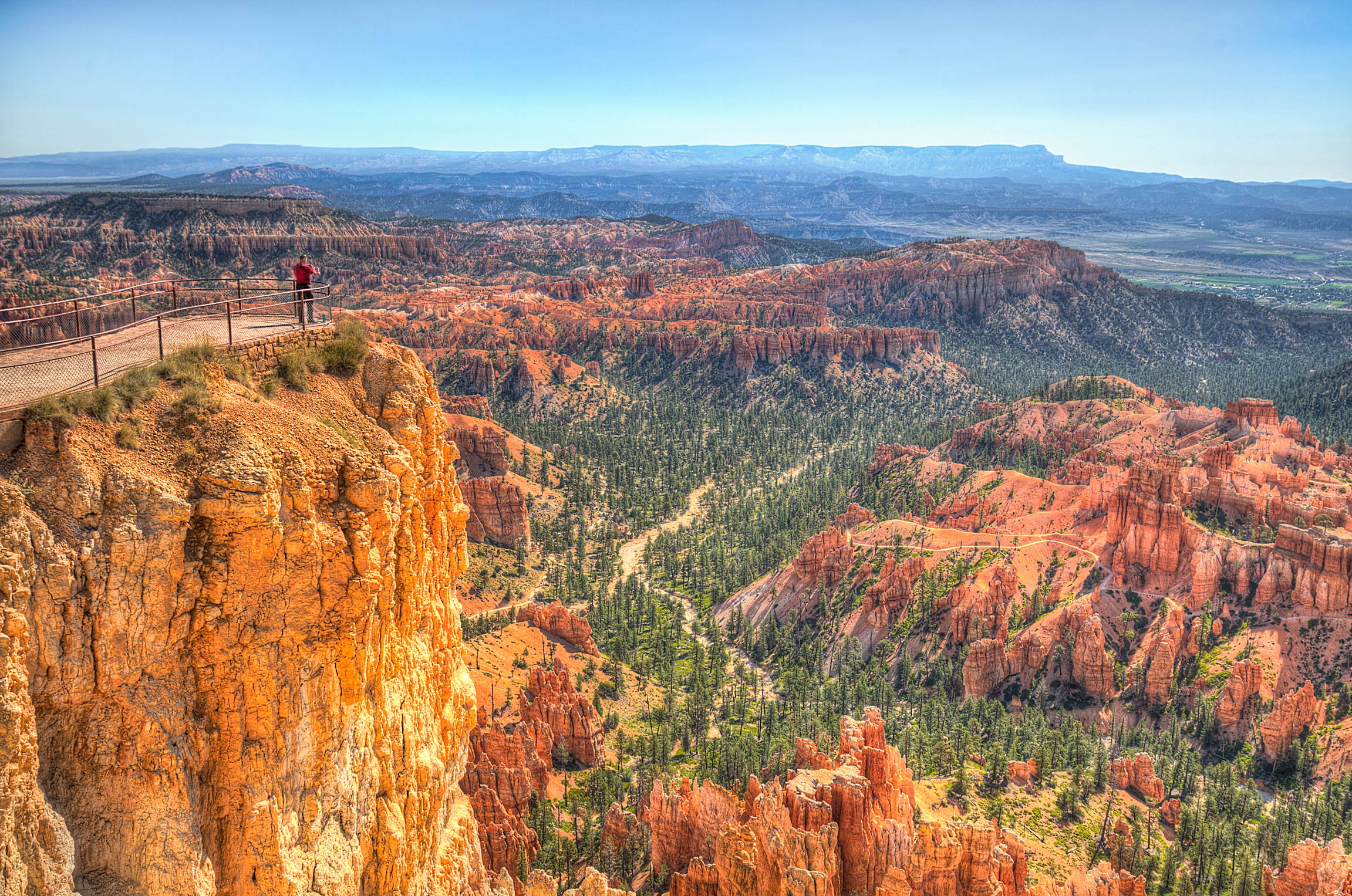
As both the driver and the photographer on this trip, I found this situation to be perfect: covering a distance of 18 miles in minutes instead of hours, I could casually roll up to a viewpoint, snap a few photos, and then immediately escape the vicious heat by hopping back into the air conditioned car. However, my misguided masochistic nature eventually got the better of me and I began looking for a trail that would take me deep into the canyon.
The end result was a trail called the “Peekaboo Loop,” which at the outset seemed innocent enough at only 3 miles in length and starting a relatively low elevation of 7,400 feet.
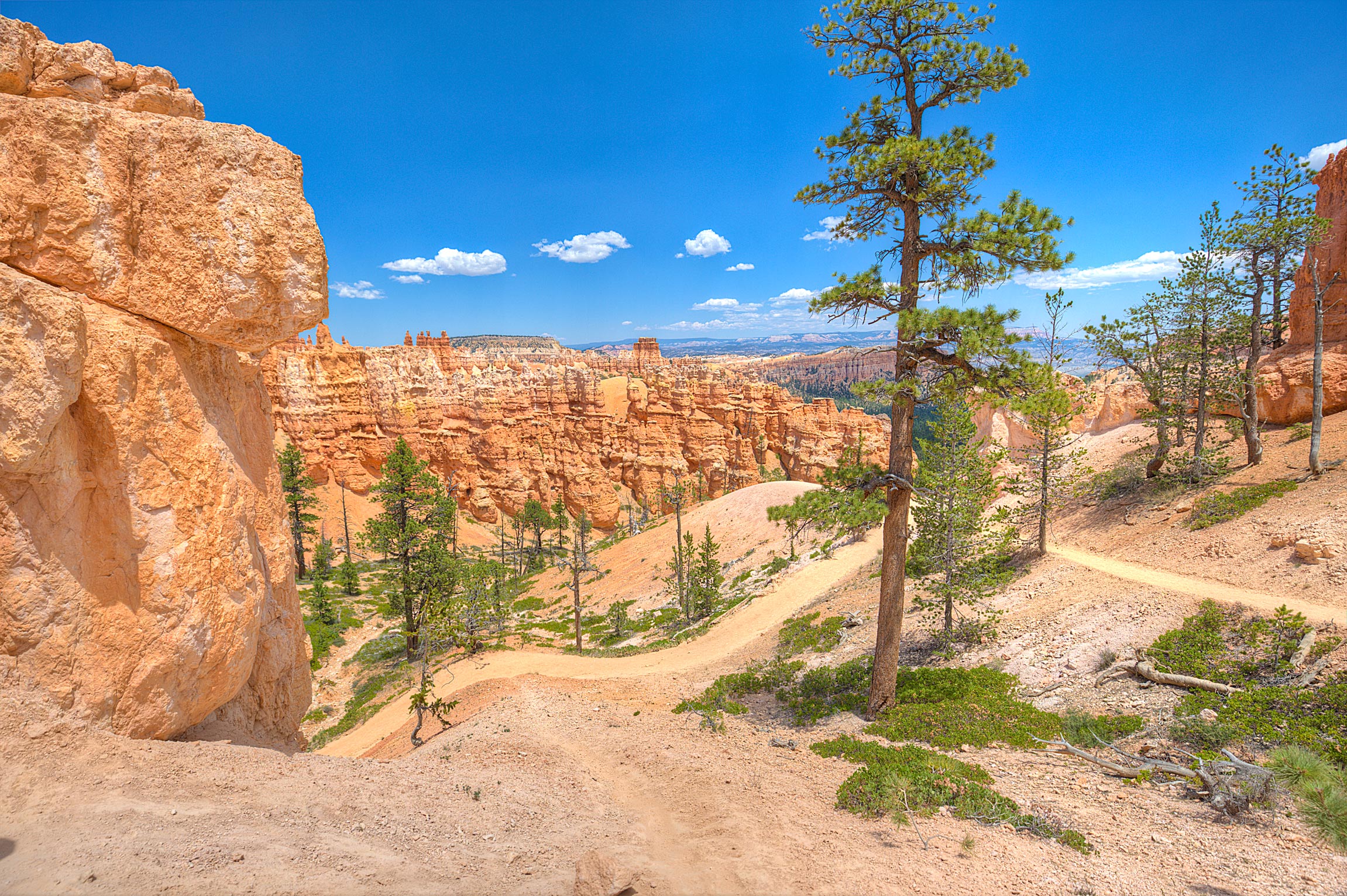
However, since the rim of the canyon amphitheater is actually at 9,000 feet, that meant that at end of my super fun tramp through this infernal, shadeless landscape, I like Dante entering the next circle of hell, had to tramp back up 1,600 feet to get to our car. Adding in that I had somehow managed to trip and fall face first down a rockslide during the hike (forever tainting my angelically white shirt), I was pretty relieved when I finally escaped.
-Summary-
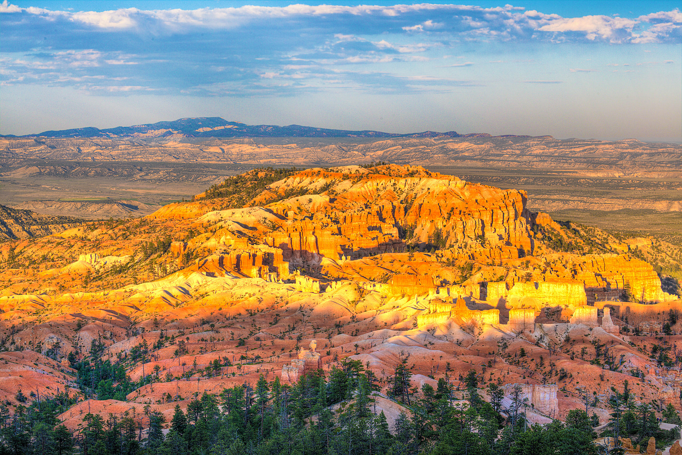
Despite my complaints about the hiking and the heat, I actually found Bryce to be my favorite park I’ve visited so far and I expect it will remain near the top as I pursue the remaining 55 parks. Located in a tiny town and totally removed from all the Disneyworld-esque bullshit we had to wade through at Zion, Bryce Canyon is an absolutely stunning park to visit. I made of point of coming back to the park for sunset, which amongst a surprisingly small number of people, I got to witness the hoodoos and rock formations light up in a beautiful orange glow.
Next up I am off to our final park on my Utah trip, Capitol Reef National Park. So long for now!
-MB
P.S. Bonus Images: