Rain pounded my windshield, wind howled across the road, and fog obscured nearly every inch of the landscape in front of me; this was an ominous sign, I thought to myself as I drove into one of the oldest National Parks in the United States: Mount Rainier.
Located just 65 miles south of Seattle, Mount Rainier was made a National Park in 1899 by President McKinley in small part due to lobbying by preservations like John Muir and in large part due to the danger this active “stratovolcano” presents to the surrounding area. Although it now been over 100 years since the last recorded volcanic activity, Mt Rainier remains active and it is estimated that an eruption would not only devastate cities like Seattle and Tacoma, but also spread ash to areas as far as Vancouver and San Francisco.
Entering from the park’s South entrance, volcanic eruptions were the least of my concerns though as the relentless, rolling fog had reduced visibility to less than 15 feet and the ground that I had planned on camping on looked like the inside of a fudge Pop-Tart. Weeks earlier, in a act of misguided manliness I had proclaimed that I would be camping and backpacking in this Park; however, one look at the clumps of depressed campers huddled together under their rain flies was enough to convince me that maybe camping can wait for another park and I quickly booked a hotel room for the next two nights.
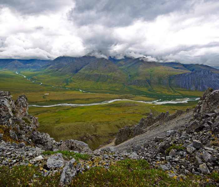
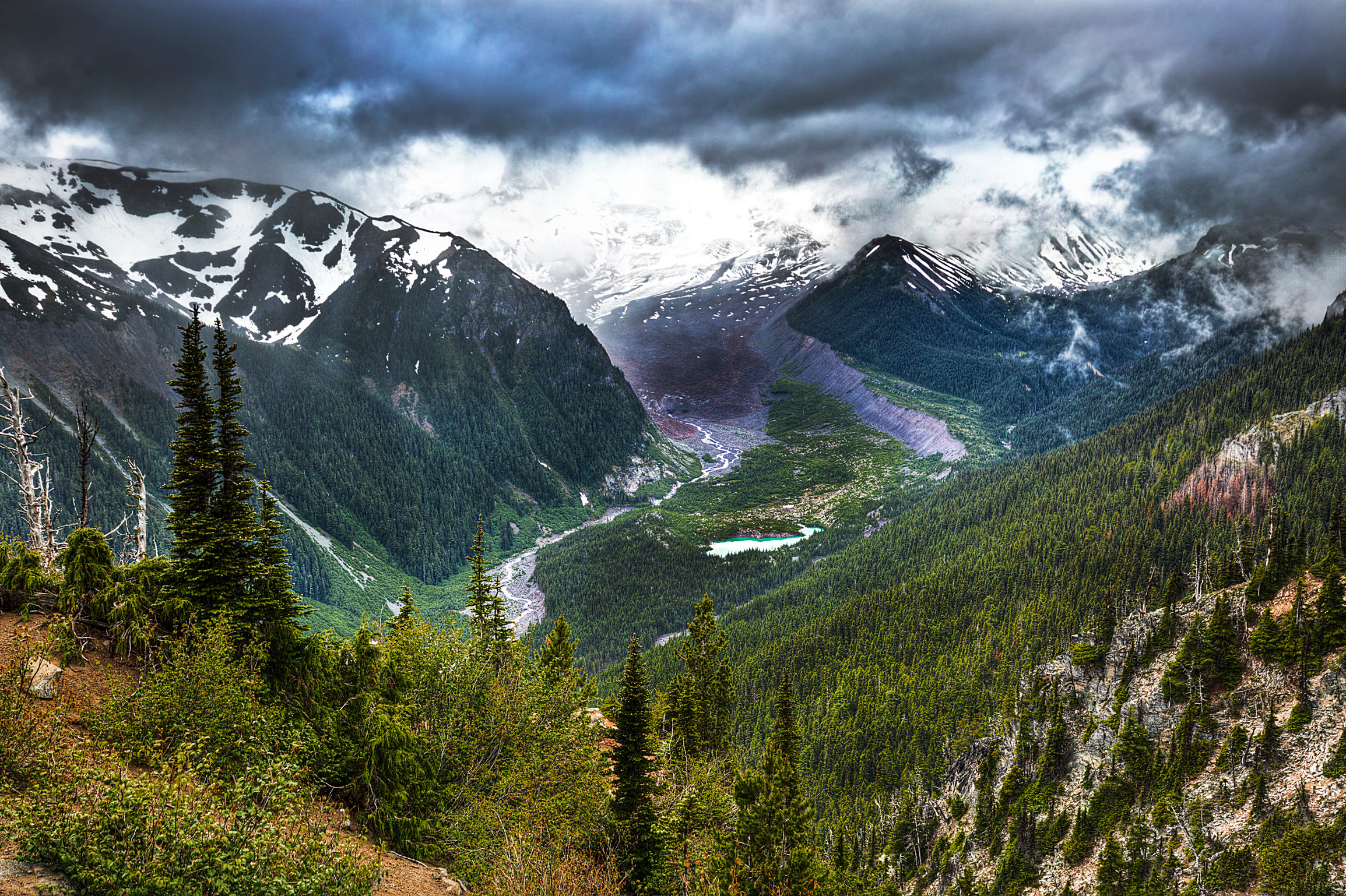
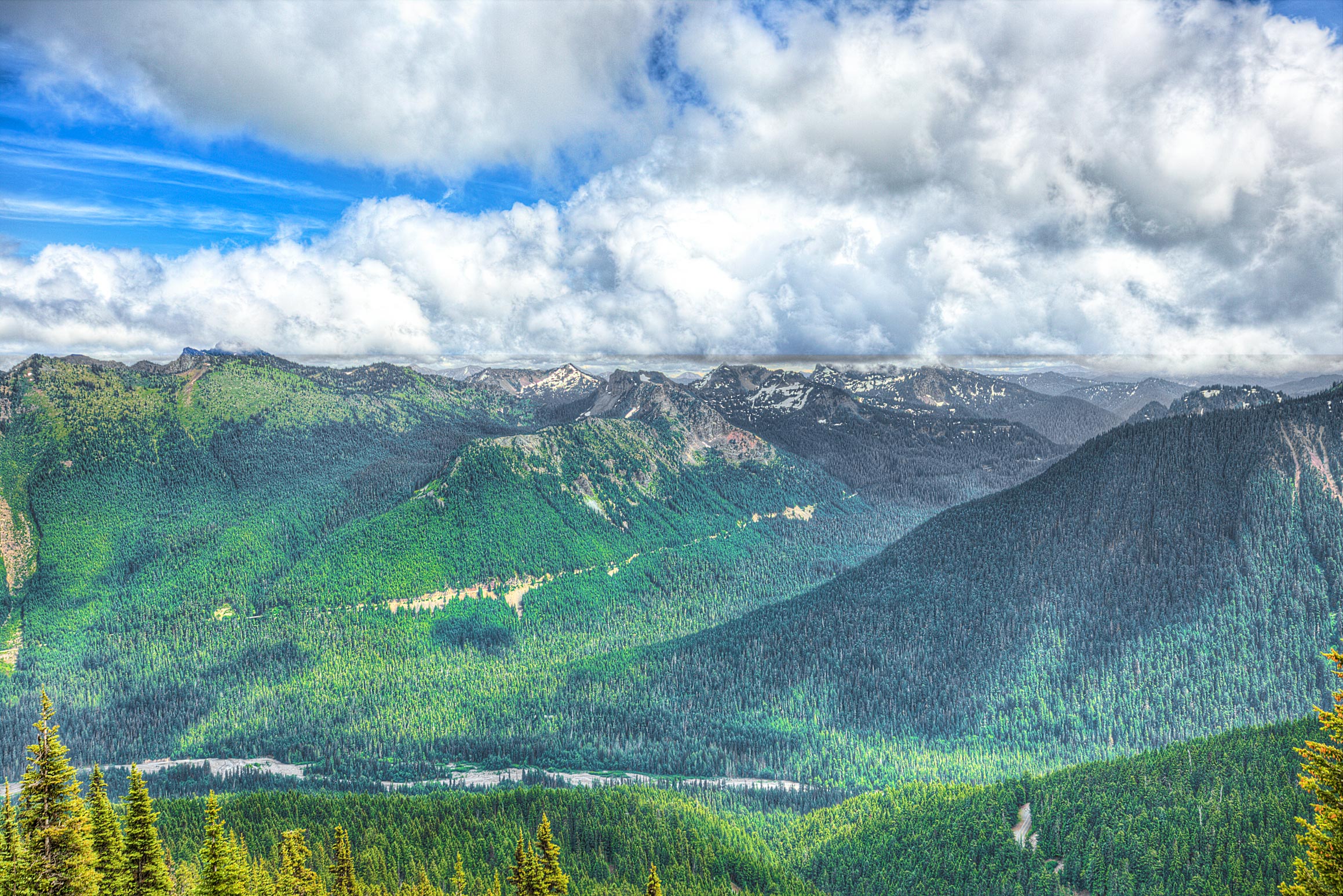
I also quickly found that touring the park in this weather was an exercise in futility, as I would go the entire day without seeing even a glimpse of Mount Rainier. The best view I got all day was of the mountain range on the opposite side of it, which if completely visible would likely show some of the glaciers in the area:
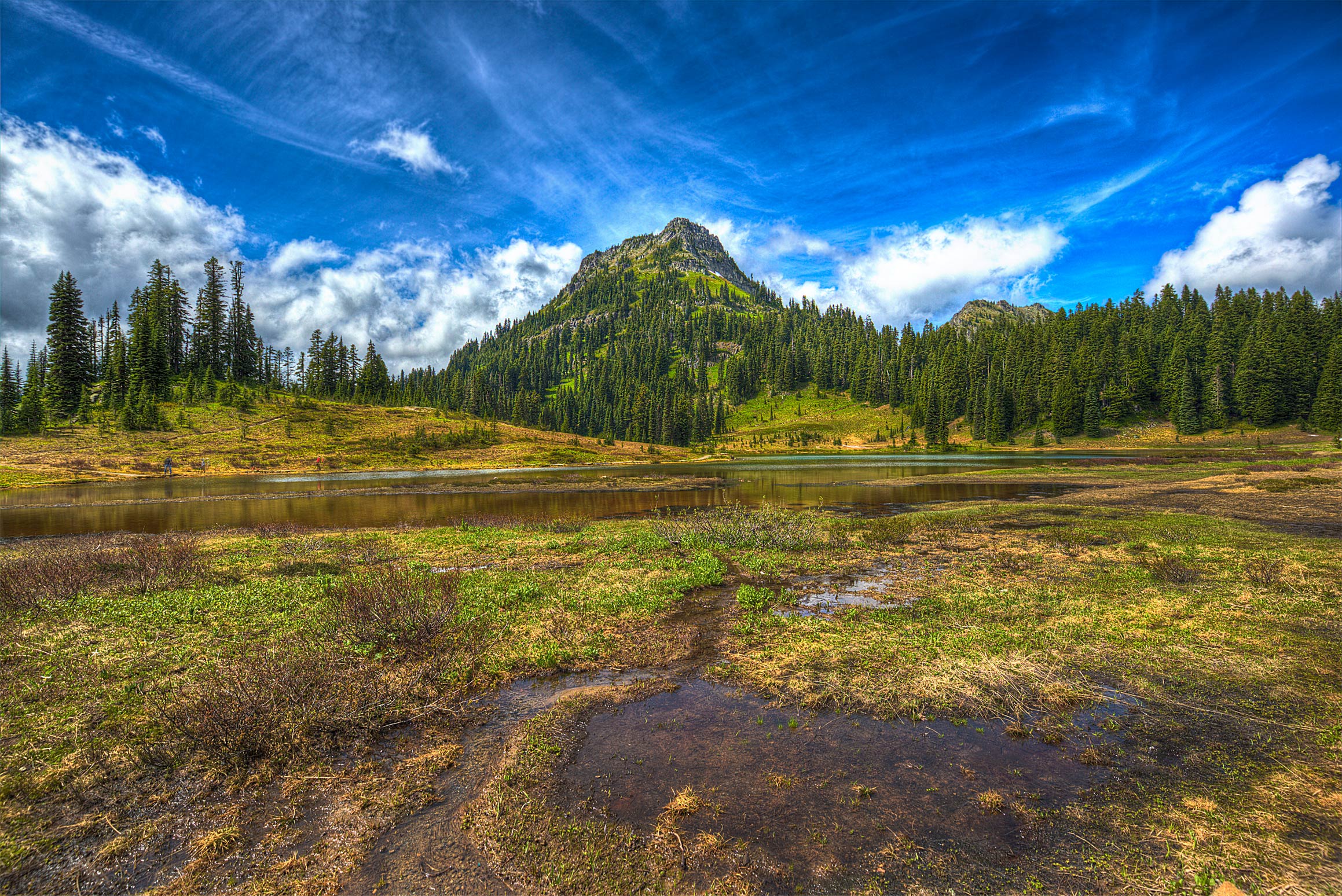
Day 2 in the Park got off to a much better start: entering this time from the East entrance, I made my way over to Tipsoo Lake, which (allegedly) had stunning views of Mt Rainier. However, this too would prove to be false, as even though most of the sky was clear, the damn mountain continued to hide behind a thick blanket of fog. With literally nothing to photograph towards the West, I faced my camera East and took this picture of the Lake:
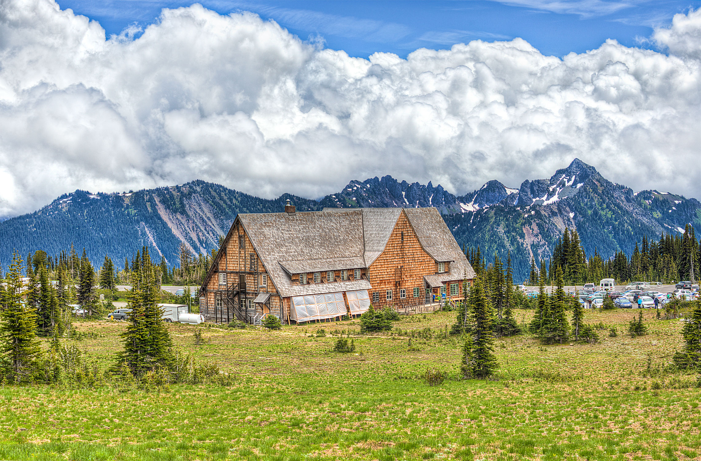
With the fog beginning to clear around the mountains, I optimistically made my way up towards the East Visitors Center, called “Sunrise,” in a vain hope of catching a glimpse of Rainier. In what would continue to be an extended cat and mouse game, the mountain would appear for a split second before completely disappearing again. That said- the area around the Sunrise Visitors Center was clear and absolutely gorgeous:
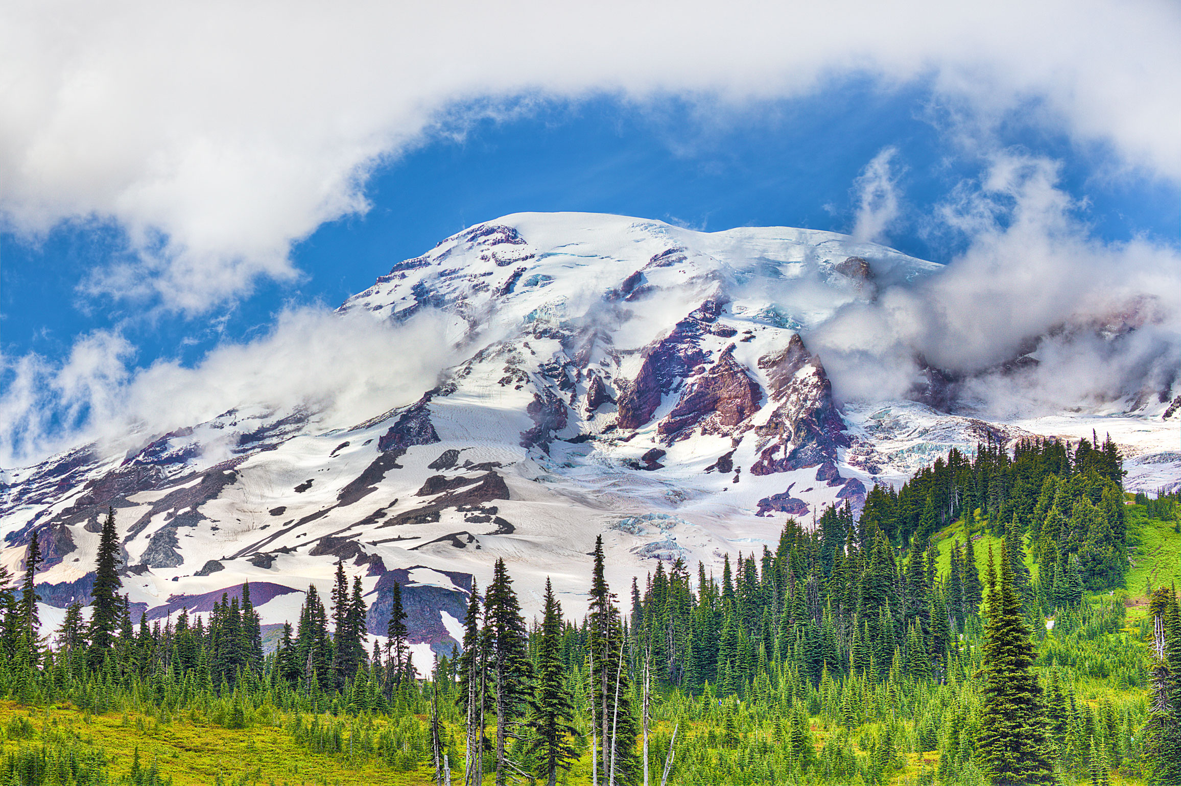
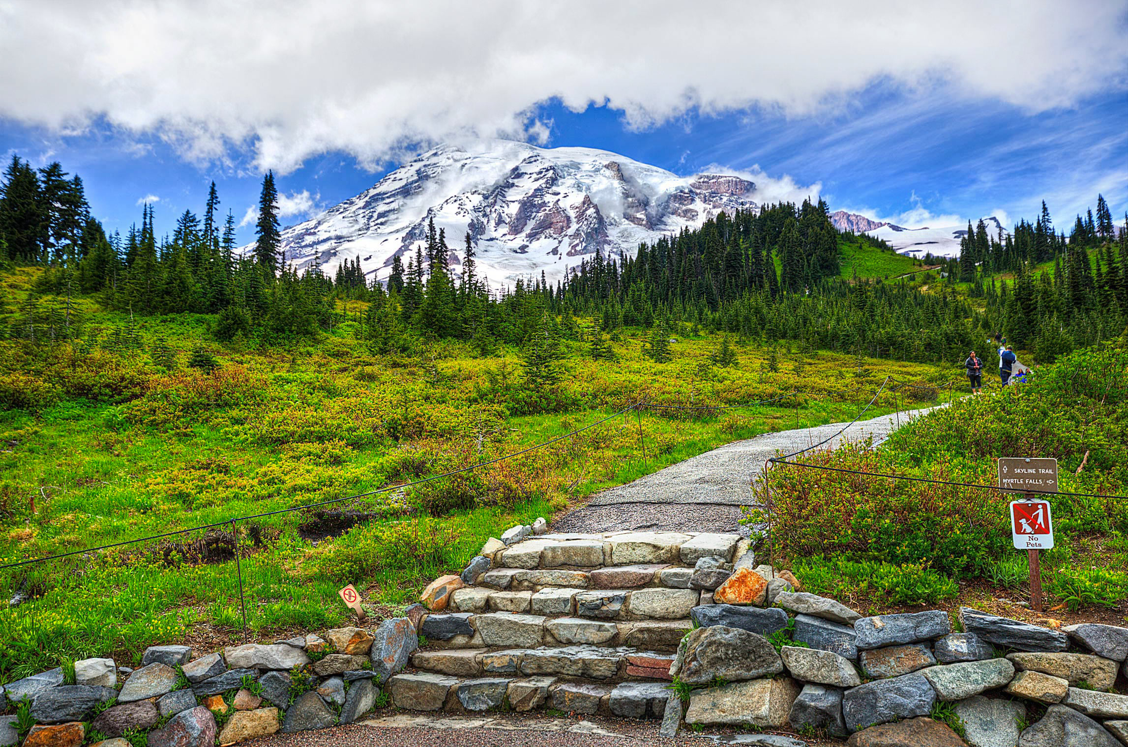
The rest of the day spent fighting against the weather gods: an hour of sunshine would be immediately followed swiftly by rain and fog, quickly blocking out any visible landmarks on the horizon. In a desperate attempt to see Mount Rainier at least once before I left the park, I circled all the way back around the park to the South Visitors Center called “Paradise.” It would be here- as I was rolling into the parking lot- that I would at long last catch my first view of Mount Rainier!
This horrendous weather made this park a challenge from start to finish, as nearly every time the sky started to look clear, a fresh wave of rain and fog would roll in. As with everything in the Pacific Northwest, the elements are the enemy and it takes a great deal of patience to see the park. This is my last stop in Washington before heading back to California to see King’s Canyon and Sequoia- so long for now!
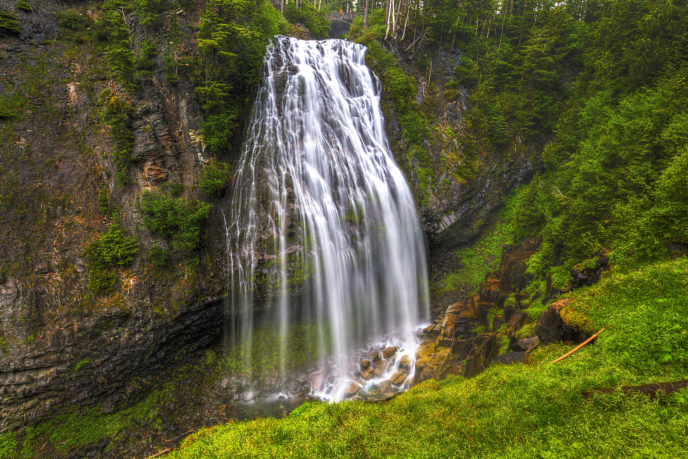
P.S. Bonus Image of Narada Falls: