National Parks #11 & #12: Kings Canyon & Sequoia
#11 and #12 of 59 US National Park Series
7/15/16-7/16/16
With huge trees, big mountains, and massive caves, Kings Canyon and Sequoia National Parks are emblematic of California’s highly-diverse natural landscape.
Located roughly an hour from the great town of Fresno California, Sequoia and Kings Canyon are separate but jointly managed National Parks resting on the western edge of the Sierra Nevada Mountain Range. Best known for their sizable quantity of large Sequoia Trees (which is a fatter, shorter version of the Coast Redwood), both parks have been protected since the early days of the US Park System (1890 and 1940 respectively).
As a change of pace, I decided to try and camp in these two parks- using the National Park’s Windows 95-esque online booking system to reserve my campsites. Prior to this trip, I thought I had camping pretty well figured out- buying the basics of a tent, sleeping bag, sleeping mat, and portable camping stove; however, upon waking up at my first campsite in Kings Canyon, I immediately realized that I was playing in the minor leagues: at nearly every campsite around me, people had setup massive RV “cities”, complete with large wooden tables, refrigerators, and full-size outdoor grills. Also puzzling was the fact that none of the other “campers” seemed to be going anywhere- in fact, I came back later in the day and most of them were still there! Clearly I had to a lot to learn (or unlearn) about National Park “camping”…
From the campsite I made my way North along the road called “The Generals Highway,” which forms a semi-circle around the Western edge of the two parks. In terms of landscape, the Western edge of the parks is mostly forest and hills, while the Eastern edge is entirely made up of the Sierra Nevada Mountains. There is no road connecting the the West and East sides- so the only option for seeing both is to visit them separately or backpack between them. Luckily, like most good National Park roads, the General’s Highway is full of scenic pullouts and short hikes. Here are a few highlights:
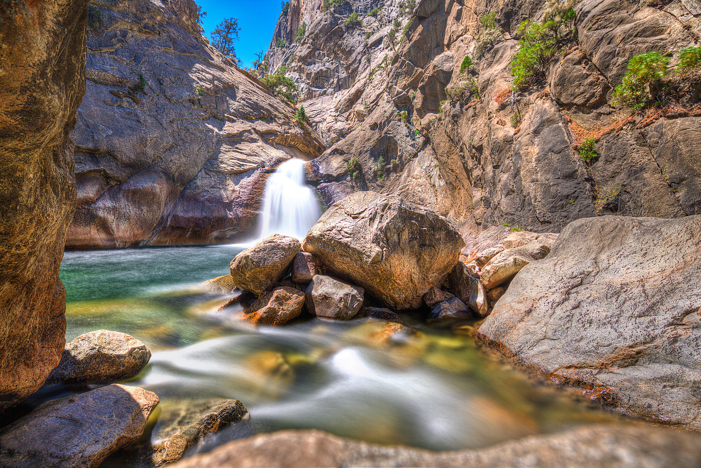
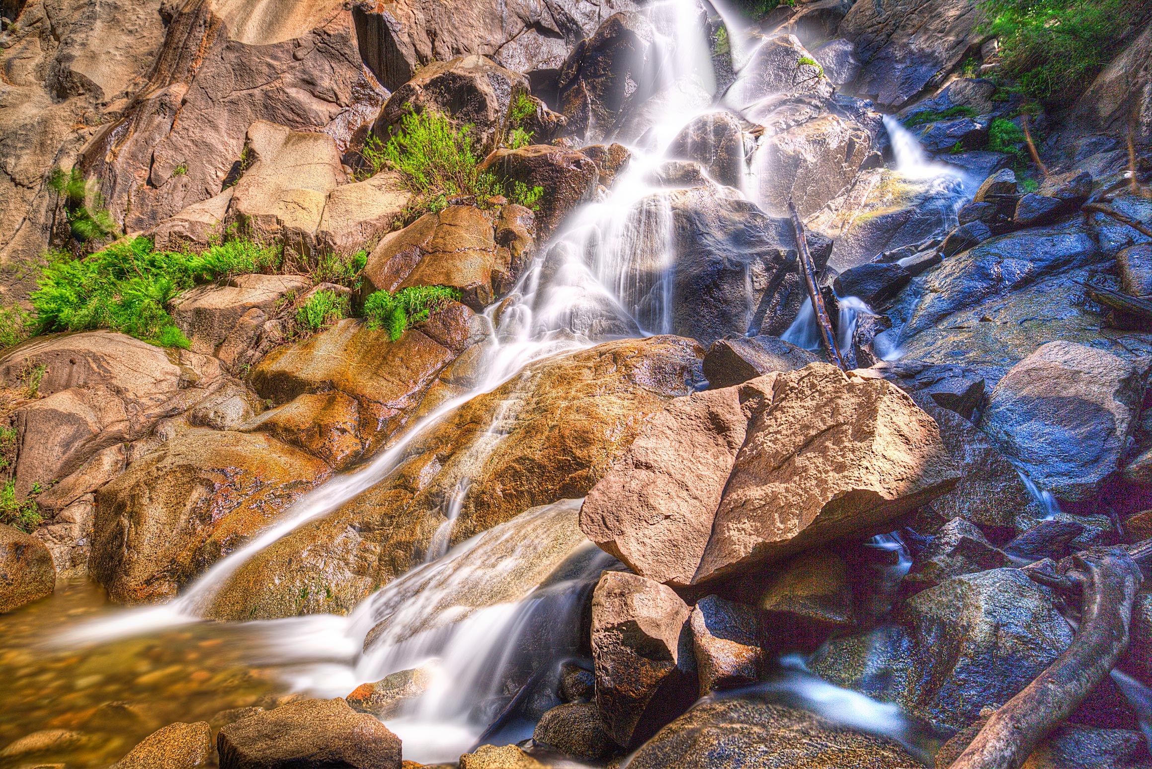
1) Grizzly Falls (Sequoia)- a medium-sized waterfall easily accessible from the road, this stop is best to see earlier in the day, as parking is limited and it gets quite crowded:
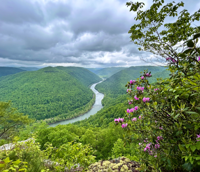
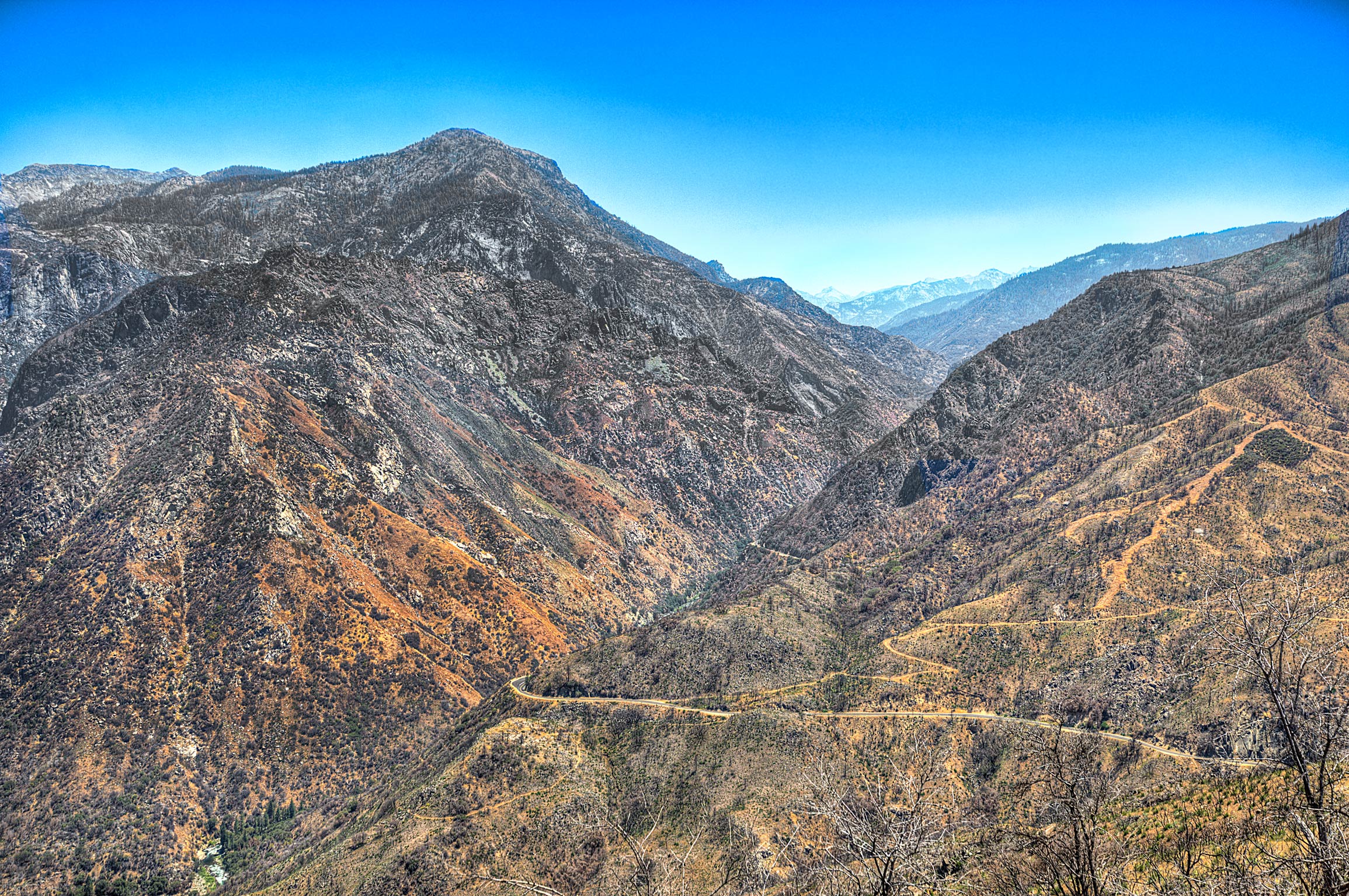
2) Junction View (Kings Canyon)- As you can see from the photo below, this is a viewpoint on a winding section of the Generals Highway. The “Junction” is where two forks of the “Kings River” combine and cut through the Canyon (thus the name “Kings Canyon”):
3) Roaring Rivers Falls (Kings Canyon)- Today’s cover photo! Located right before the Generals Highway ends in the North, this waterfall can be either be reached from a parking lot about .5 miles away or hiked from the nearby “Zummalt Meadow.” If you’re into hiking, I would recommend going the Zummalt Meadow route- it’s quite beautiful and I even saw a small Black Bear sitting in a bush there (regretfully I did not get close enough to take a postable picture though 🙁 )
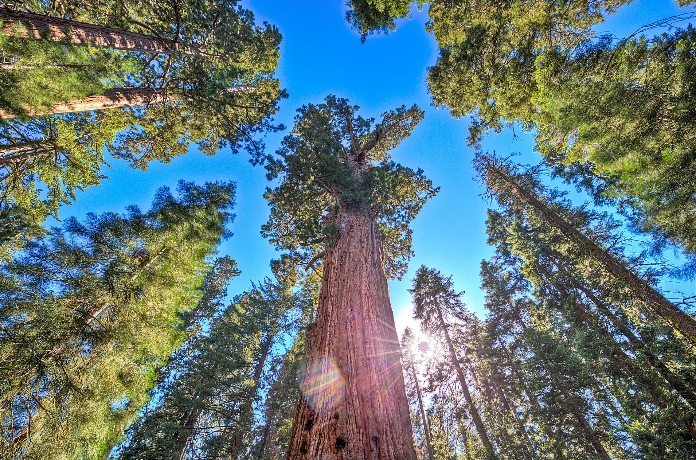
4) The General Sherman Tree (Sequoia)- Bizarrely named after a man famous for burning buildings to the ground, this is probably the most iconic landmark in the Park: a massive sequoia tree that with a circumference of over 100 feet and height of 275 feet, is the largest living tree (by volume) in the World:
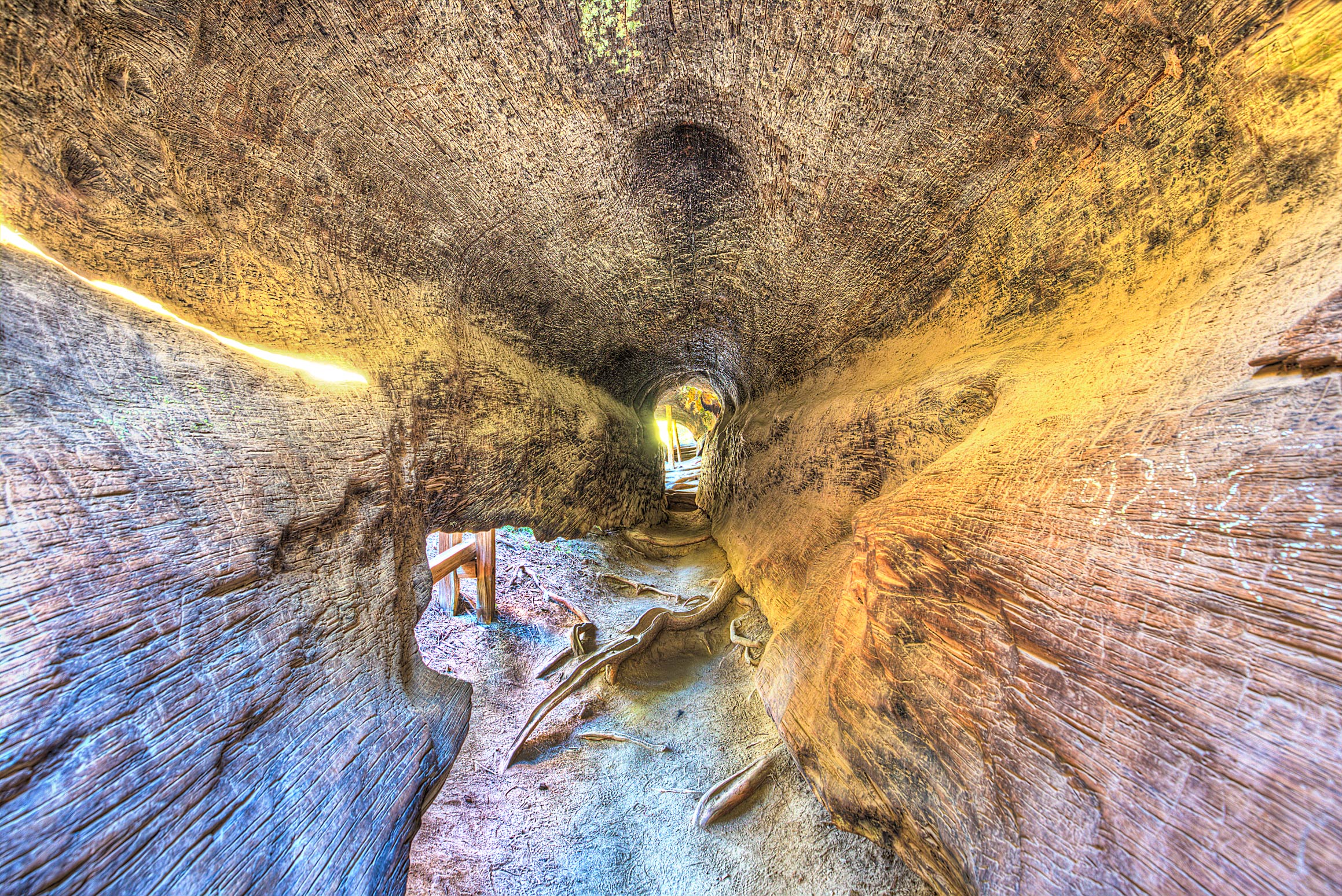
5) General Grant Grove (Sequoia)- Also a big tree. The tree itself is not that interesting to look at (especially after seeing the General Sherman), but there’s a cool tree-trunk that can be walked through near the entrance to the trail
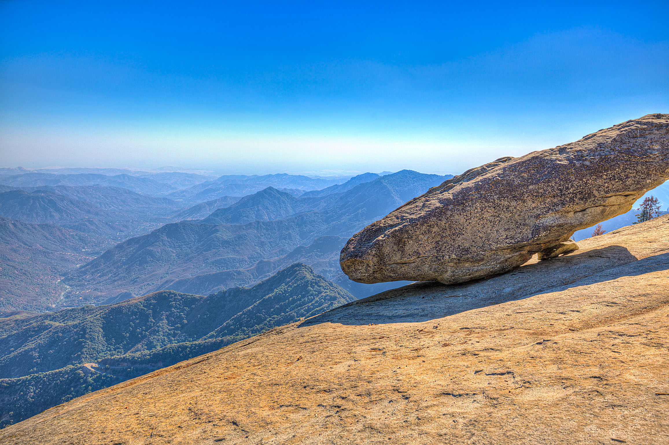
6) Hanging Rock (Sequoia)- Located on the Southern end of the General’s Highway, this is right next to Moro Rock (which is also cool). Of all of the viewpoints in both the parks, this was my favorite:
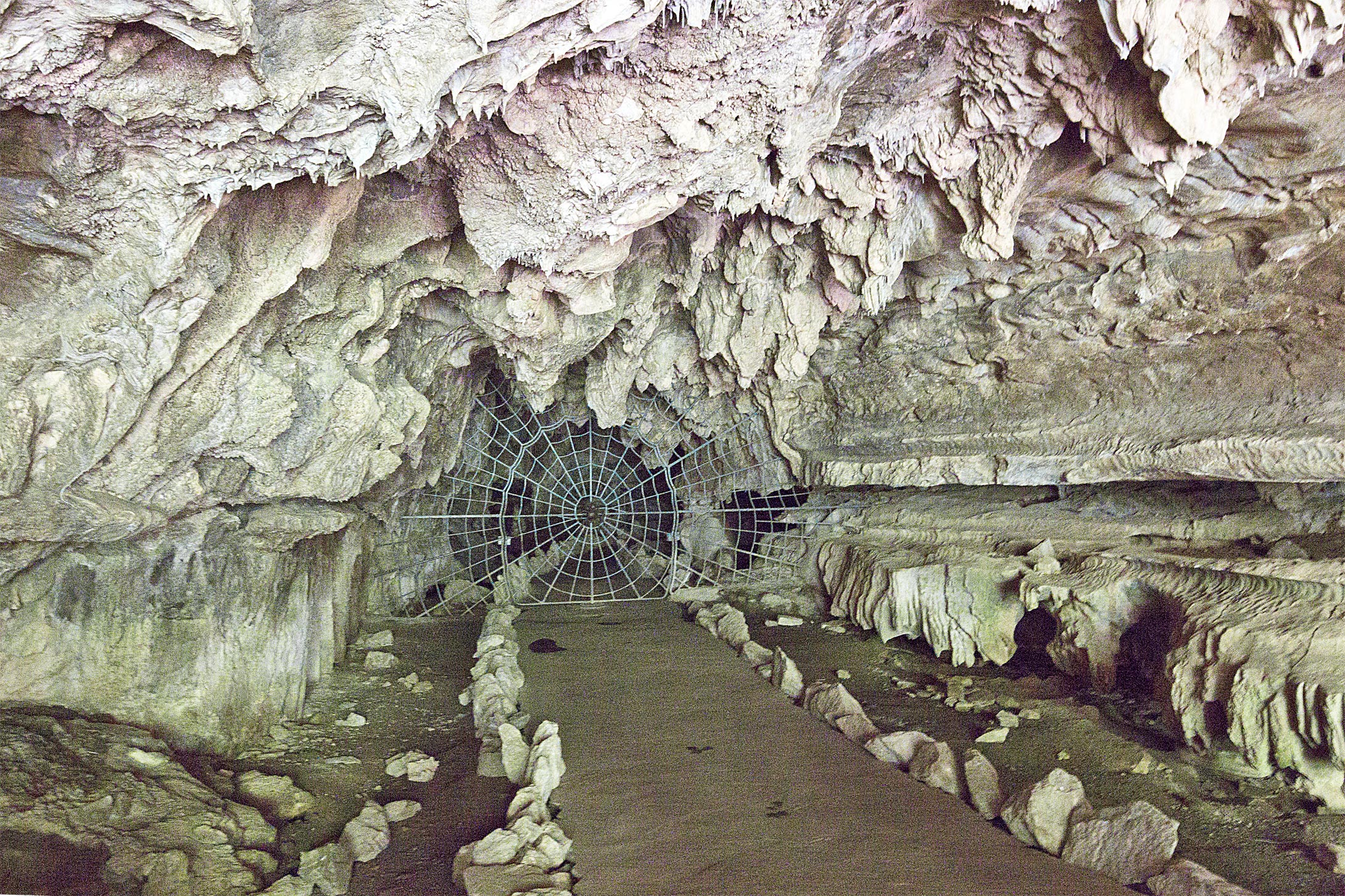
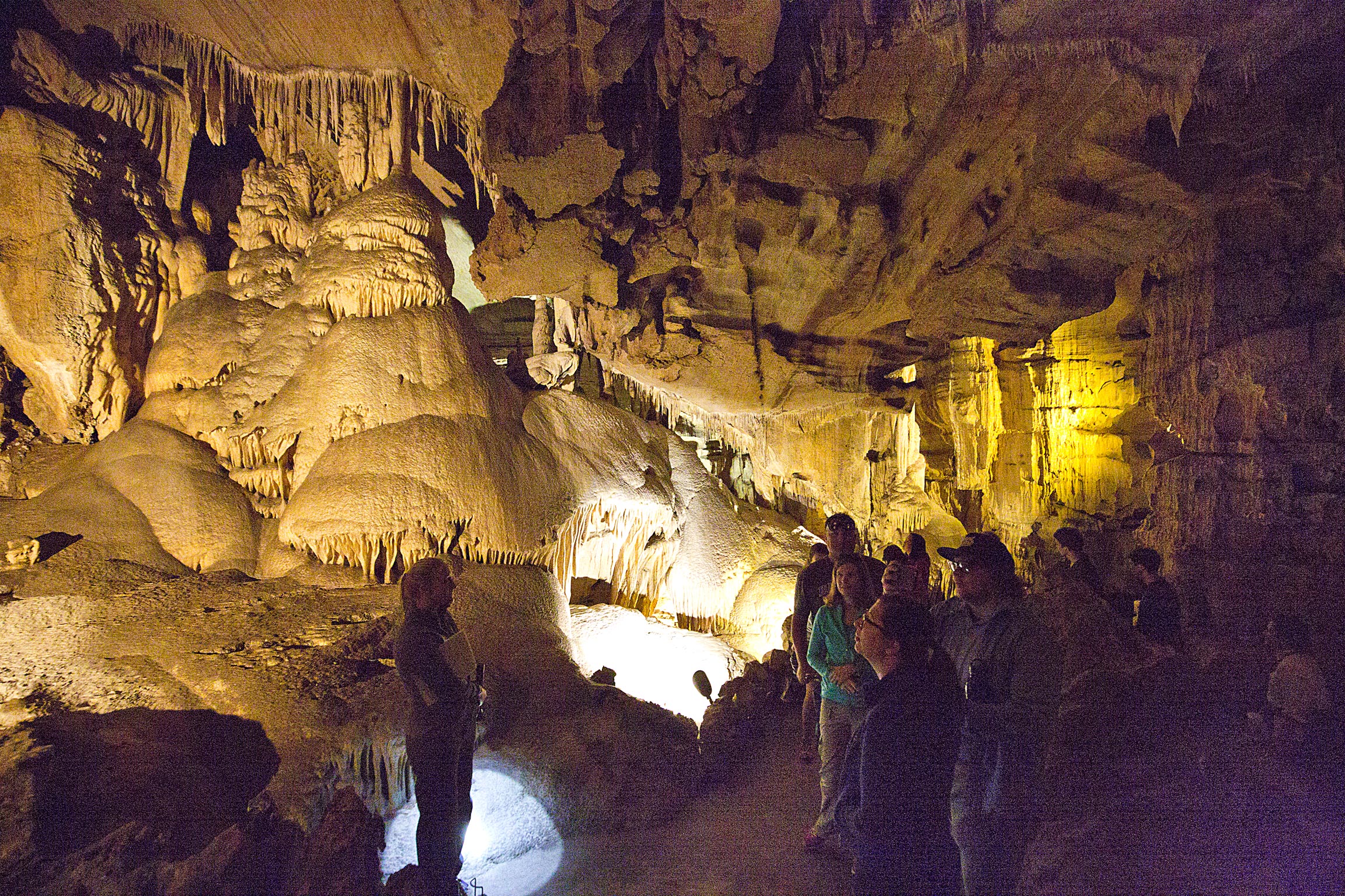
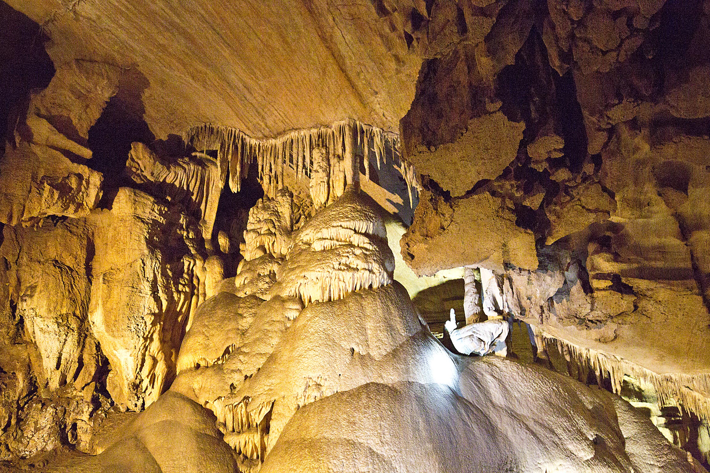
Traffic and progress on the Generals Highway is slow- so the above 6 stops/hikes took me an entire day (starting at 7am at the campsite) to complete. Day 2 in the park was spent at Crystal Cave, which is a medium sized cave on the Southwestern side of Sequoia. It’s only accessible by guided tour and on crowded days tours need to be booked online ahead of time (although from our experience, there always seem to be a few no shows). Unfortunately they do not allow tripods in the cave, so my photography efforts were limited to just the heavily lit areas (which is not very many). Here are a few from the visit:
1) The Entrance to the Cave:
2) On the Tour:
3) A Closer Look:
I spent a total of two days in Sequoia and Kings Canyon National Parks, and while that is more than enough time to see the easily-accessible areas of the park (i.e. reachable by car), it just barely scratches the surface of what these two parks have to offer. In the near future, I’d like to come back and explore the Backpacking portion of the parks, which not includes Mt Whitney- the tallest mountain in the contiguous US- but also portions of both the John Muir and Pacific Crest Trails.
Next up, I am headed all the way to the East Coast of Maine to see the one and only, Acadia National Park!
Cheers!
-Morgan