Beautiful green tress, a rugged blue coastline, and the fresh smell of popovers define America’s only park in the North East, Acadia National Park.
Looking at a map of the United States Park System, Acadia stands out like a beacon, as it is situated almost 800 miles from the next nearest National Park. This relative isolation was the result of the unusual circumstances in which Acadia was formed: rather than the Government forcefully/rightfully taking over the land using the Antiquities act, the land was donated directly to the Government by its wealthy owners, Charles W. Eliot (then President of Harvard) and George B. Dorr.
Originally named a National Monument by Woodrow Wilson in 1916, the combined funding efforts and advocacy from Dorr and later, John D. Rockefeller Jr, would result in the area being quickly expanded into a fully protected National Park in 1919, originally under the name “Lafayette”(a French supporter of the American Revolution) and later changed in 1929 to “Acadia” (the name of one the first French colonies in North America).
Today, Acadia is one of the most visited National Parks in the United States, with over 2.5 million people making the trip to eastern Maine. I had flown from San Francisco to Portland for a wedding and then had the good fortune of being to able to say with my cousins at their house near Camden, which is only about 1.5 hours from the Park.
Entering the from the West side at the “Cadillac Mountain Entrance” my cousins and I made our way half around the popular “Park Loop Road.” Following the treasured American tradition of driving, stopping for photos, and then driving again, the Park Loop Road circles the main areas of the park, providing parking lots at all of the various viewpoints and day hikes. Here are a few of the places we stopped:
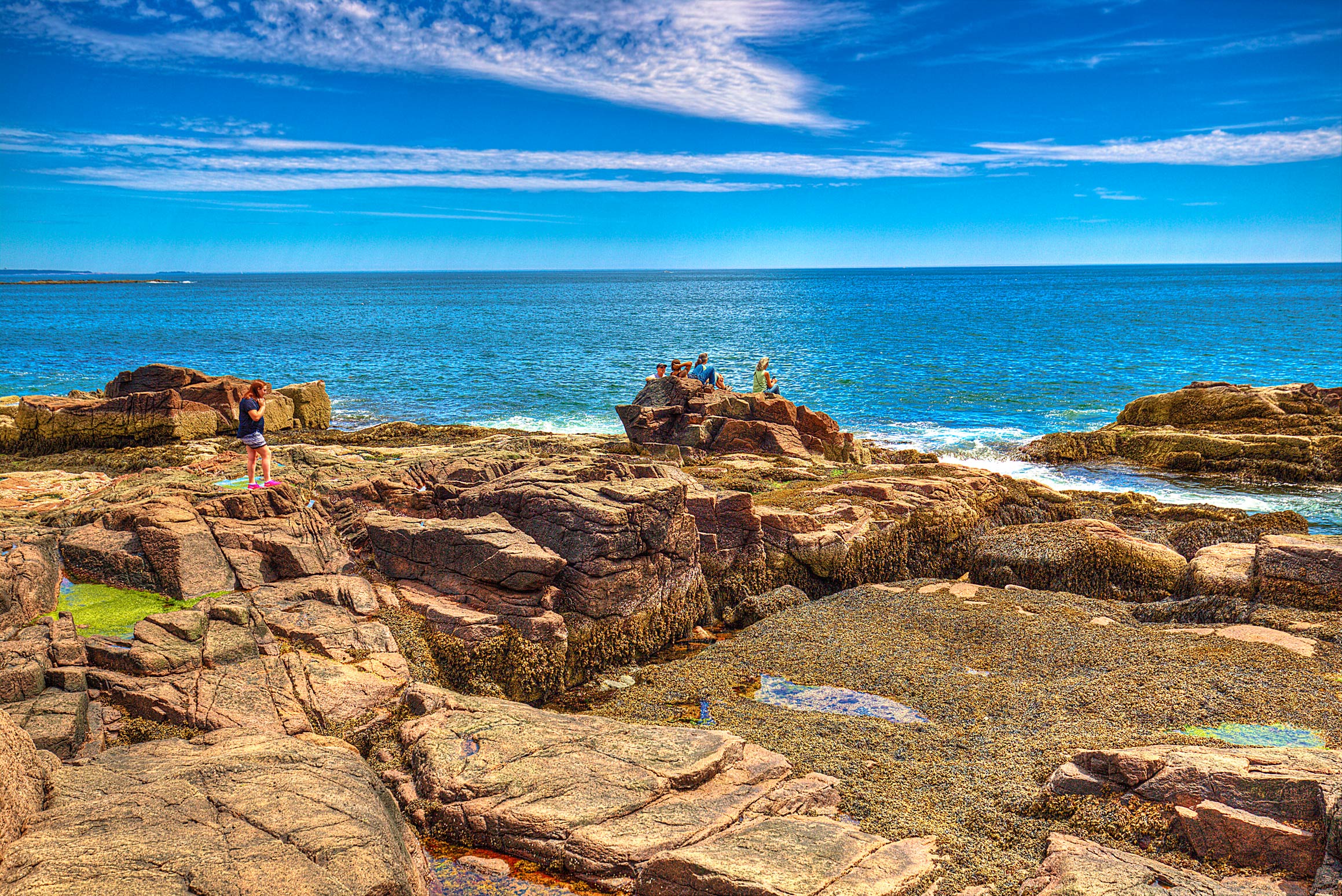
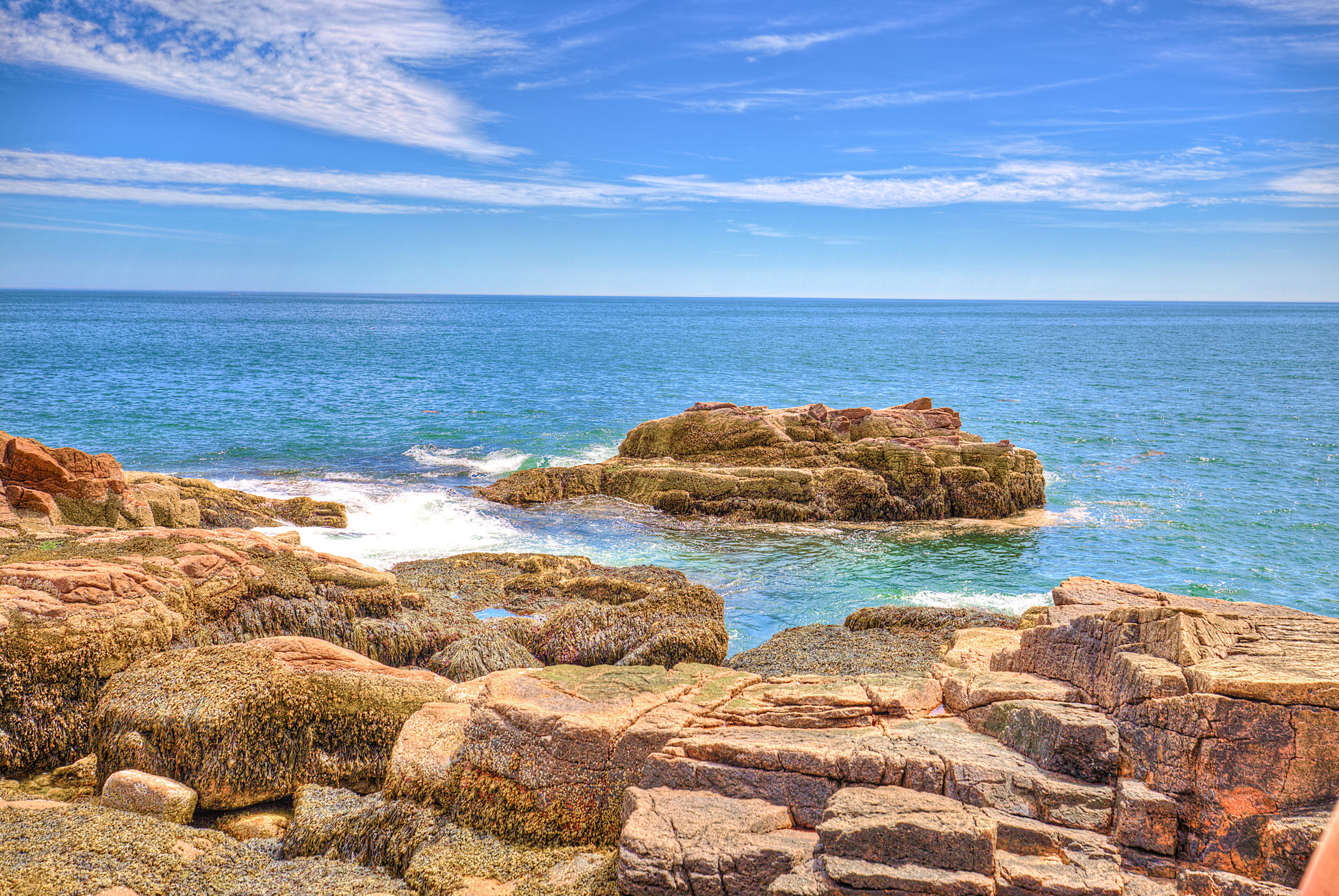
1) Overlooks near Schooner Head:
There are dozens of overlooks along the eastern side of the park, all which basically look exactly the same:
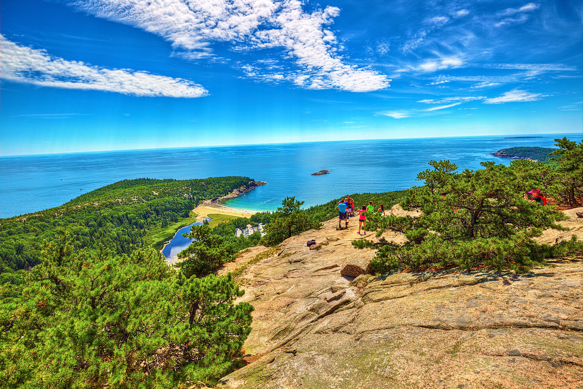
2) The Beehive:
Unfortunately the hike we wanted to do (called “The Precipice”) was closed due to Falcon Nesting, so we decided to try this hike instead! The beehive is a short, but almost completely vertical hike to the top of a 520-foot mountain called “The Beehive.” The Beehive hike involves climbing up ladder-like metal rungs that have been dug into the exposed face of the mountain- so if you’re afraid of heights, this is not the hike for you. That said- the view at the top is beautiful:
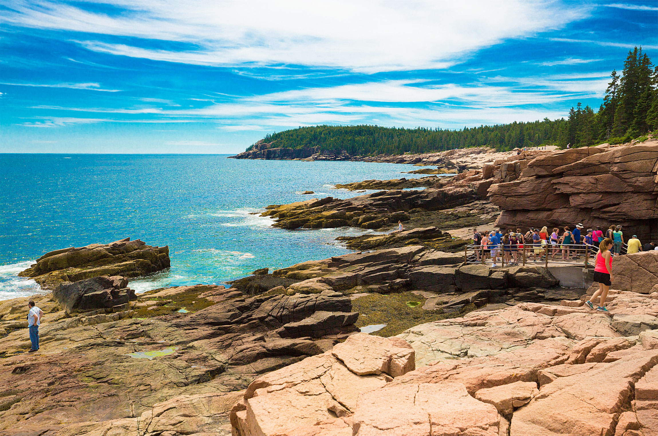
3) Thunder Hole:
Depending on the time of day and how high tides come in, Thunder Hole varies from being extremely calm to highly treacherous. The name comes from the “thunderous” sound of big waves hitting the rocks, which at high tide completely wash over the viewing deck. Fortunately (I think) we visited during low tide, so we got the see the more peaceful side of Thunder Hole:
Paying homage to the French culture that the Park founders so closely cherished, we then decided to rent bikes and make our way down the “Carriage Road”- an impressively well-maintained gravel road that cuts vertically through the center of the park. Starting at the Northern end of the trail, we rode all the way down South to a place that could only exist in a National Park that was funded by East Coast Millionaires: a full-service restaurant called “The Jordan Pond House.”
Situated on the Jordan Pond and bustling with activity, the Jordan Pond House has become famous for its “popovers”, which look like an odd mixture between a muffin and croissant. According to Wikipedia, popovers were originally meant to be the American version of Yorkshire pudding, but have “evolved considerably” to now where we primarily just eat them as a sweet or a dessert:

I was too busy eating popovers to take a photo of one, so here’s a photo form the Public Domain!
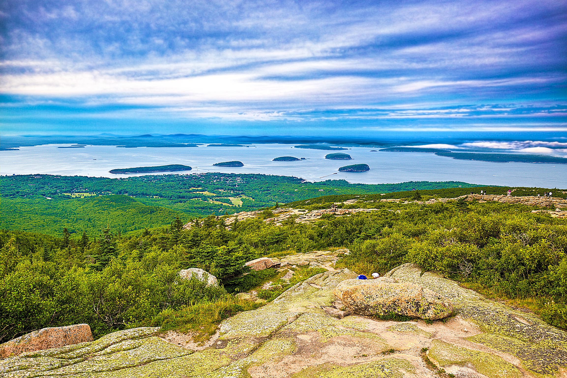
After riding back to the start of the Carriage Trail and returning the bikes in Bar Harbor, we set out on one last hike for the day: the climb to the top of the highest mountain on the North Atlantic seaboard, Cadillac Mountain. Standing at a ferocious 1,530 feet, we decided to find the most difficult way to climb it, settling on the mostly vertical Western side of the Mountain. Like mountaineers climbing Everest, we battled our way through the sub-2 mile hike, finally ending at the summit:
Unfortunately I only got to spend one full day in Acadia, but that day was an absolute blast. The area is stunning and I really lucked out with the weather, getting clear skies until the late afternoon. Next time I will visit for an extended period of time, but for now I am headed off to Denver to visit the Rocky Mountains!
Cheers,
MB